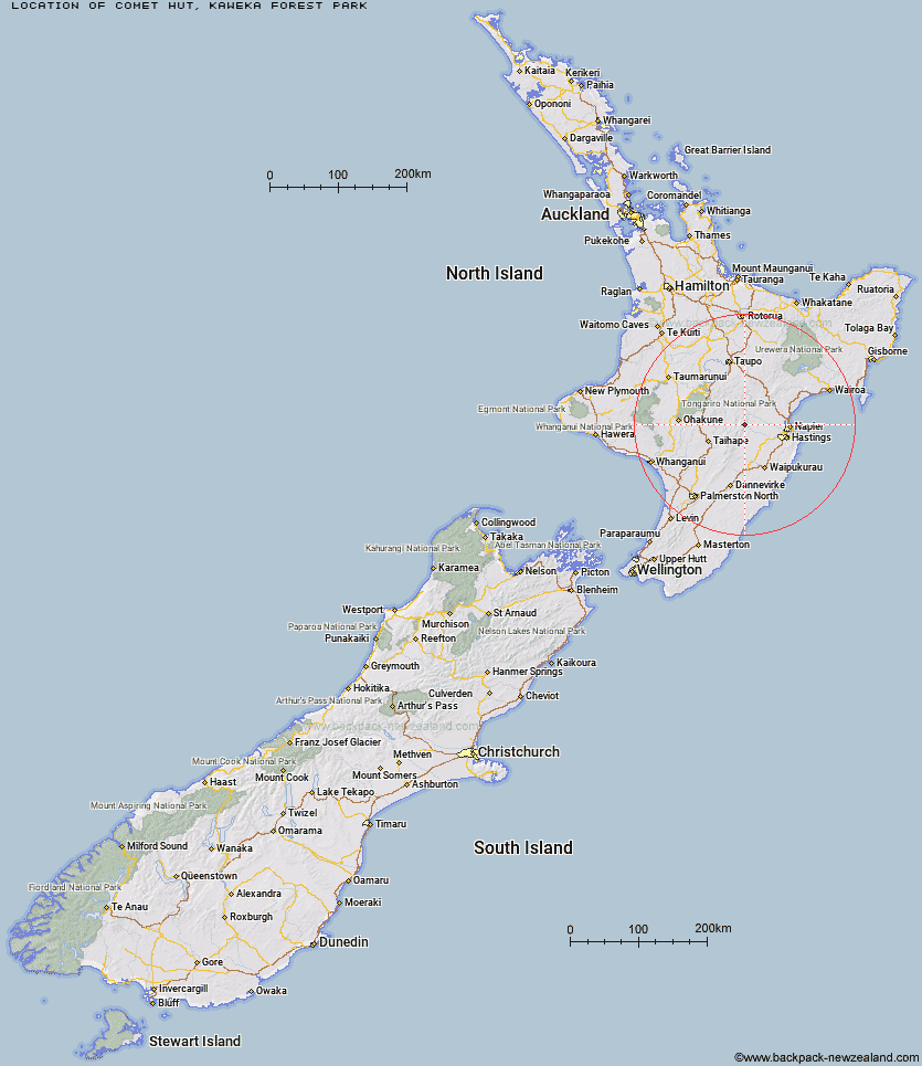
Topo Map showing location of Comet Hut
This information is sourced from DoC, LINZ and Openstreetmap. Some of the hut photos are mine and the rest are from DoC. I will be adding an upload feature soon so people can photos of .Comet Hut.
Basic info: Comet Hut is located in the southern end of Kaweka Forest Park, at the Comet Road end off the Napier-Taihape Highway.
Latitude: -39.4684161994
Longitude: 176.289740034
Location: Kaweka Forest Park
Area: Hawke's Bay
Type of Hut: Basic/bivvies
Tracks: Comet Road end to Shutes Hut
Map: BJ37 Topo Map | Road Map
Does this hut still exist? Have any more information? Contact
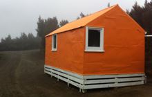
Image: DoC
Scroll down to see a topographical map and road map showing the location of Comet Hut
[ A ] [ B ] [ C ] [ D ] [ E ] [ F ] [ G ] [ H ] [ I ] [ J ] [ K ] [ L ] [ M ] [ N ] [ O ] [ P ] [ Q ] [ R ] [ S ] [ T ] [ U ] [ V ] [ W ] [ Y ] [ Z ]
Closest 20 Huts to Comet Hut
These are as the crow fliesShutes Hut 4.83km Dianes Hut 8.23km Taruarau Bivouac 8.33km Cedars Hut (Blowfly) 10.19km Ruahine Hut 10.3km Cameron Hut 11.86km Dead Dog Hut 12.22km Lowry Shelter 12.51km No Mans Hut 12.92km Herricks Hut 13.93km Makirikiri Hut 14.48km Rock Camp Bivouac 15.2km Kiwi Saddle Hut 15.3km Ikawetea Forks Hut 15.7km Kiwi Mouth Hut 15.91km Mistake Bivouac 16.12km Rockslide Hut 17.22km Masters Shelter 18.02km Mackintosh Hut 18.13km Aranga Hut 18.71km Manson Bivouac 19.05km Studholme Saddle Bivouac 19.19km Old Manson Hut 19.2km Manson Hut 19.32km Studholme Saddle Hut 19.68km Back Ridge Bivouac 20.24km Ruahine Corner Hut 20.74km Rocks Ahead Bivouac 21.43km Rocks Ahead Hut 21.45km Back Ridge Hut 22.06km Otutu Hut 22.21km Sentry Box Hut 22.29km Briens Hut 22.42km Black Birch Bivouac 22.5km Makahu Saddle Hut 22.59km Dominie Hut 22.73km Otutu Island Hut 23.02km Parks Peak Hut 23.5km Upper Makaroro Hut 24.12km Omarukokere Bivouac 24.28km