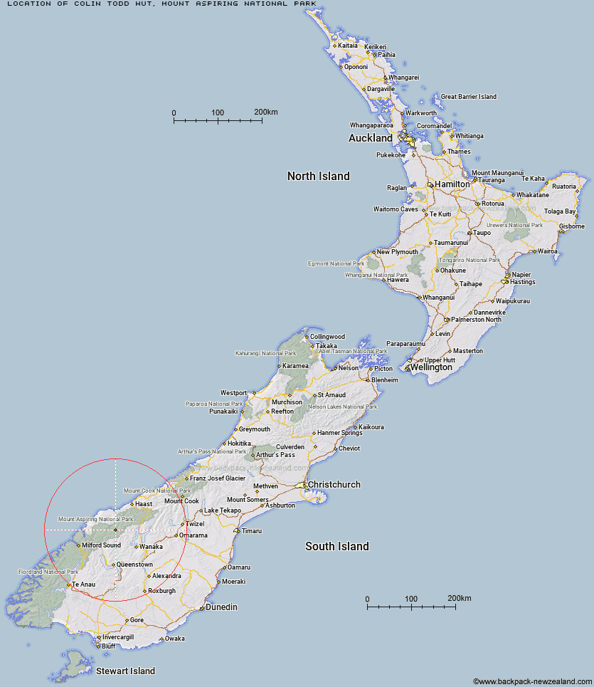
Topo Map showing location of Colin Todd Hut
This information is sourced from DoC, LINZ and Openstreetmap. Some of the hut photos are mine and the rest are from DoC. I will be adding an upload feature soon so people can photos of .Colin Todd Hut.
Basic info: This is an alpine serviced 10-bunk hut in the South Westland area and near the Wanaka/Makarora area.
Latitude: -44.3720655514
Longitude: 168.694593689
Location: Mount Aspiring National Park
Area: Otago
Type of Hut: Serviced Alpine
Map: CA11 Topo Map | Road Map
Does this hut still exist? Have any more information? Contact
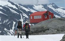
Image: DoC
Scroll down to see a topographical map and road map showing the location of Colin Todd Hut
[ A ] [ B ] [ C ] [ D ] [ E ] [ F ] [ G ] [ H ] [ I ] [ J ] [ K ] [ L ] [ M ] [ N ] [ O ] [ P ] [ Q ] [ R ] [ S ] [ T ] [ U ] [ V ] [ W ] [ Y ] [ Z ]
Closest 20 Huts to Colin Todd Hut
These are as the crow fliesScotts Rock Bivouac 5.36km French Ridge Hut 6.29km Liverpool Hut 6.98km Arawhata Rock Bivouac 8.28km Rock of Ages Bivouac 9.09km Aspiring Hut 12km Cascade Hut 13.6km Raspberry Creek Shelter 16.23km Top Forks Hut 19.04km Dart Hut 20.01km Tummel Burn Hut 21.94km Shelter Rock Hut 25.46km Lochnagar Hut 25.57km Hundred Mile Hut 26.39km Black Peak Hut 27.24km Albert Burn Hut 27.27km Kerin Forks Hut 30.92km Daleys Flat Hut 32.08km Polnoon Hut 32.44km Saddle Hut 32.91km Sixteen Mile Huts 33.6km Earnslaw Hut 33.98km Shiel Burn Hut 34.5km Siberia Hut 34.64km Twenty Five Mile Hut 34.75km Esquilant Bivvy Hut 35.39km Cabin Hut 36.59km Craigie Burn Hut 37.64km Spoon Hut 38.2km Young Hut 38.38km Olivine Hut 39.01km Wanaka Faces Hut 39.99km Ballarat Hut - Flood Burn 42.24km Stafford Hut 43.46km Sawyer Burn Hut 44.95km Gorge River Hut 45.01km Bullendale Hut 46.23km Big Bay Hut 46.78km Fern Burn Hut 46.9km Archie's Hut - Copper Creek 47.37km