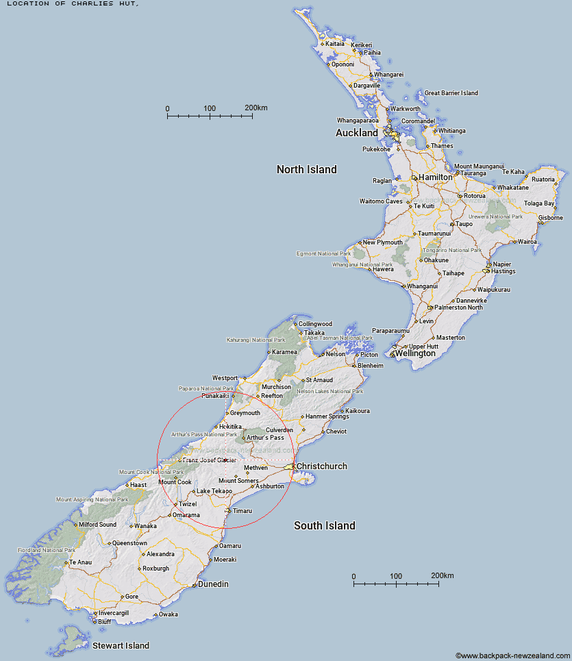
Topo Map showing location of Charlies Hut
This information is sourced from DoC, LINZ and Openstreetmap. Some of the hut photos are mine and the rest are from DoC. I will be adding an upload feature soon so people can photos of .Charlies Hut.
Latitude: -43.3814964897
Longitude: 171.176517068
Location:
Type of Hut:
Map: Topo Map | Road Map
Does this hut still exist? Have any more information? Contact
Latitude: -43.3814964897
Longitude: 171.176517068
Location:
Type of Hut:
Map: Topo Map | Road Map
Does this hut still exist? Have any more information? Contact
Scroll down to see a topographical map and road map showing the location of Charlies Hut
[ A ] [ B ] [ C ] [ D ] [ E ] [ F ] [ G ] [ H ] [ I ] [ J ] [ K ] [ L ] [ M ] [ N ] [ O ] [ P ] [ Q ] [ R ] [ S ] [ T ] [ U ] [ V ] [ W ] [ Y ] [ Z ]
Closest 20 Huts to Charlies Hut
These are as the crow fliesDowns Hut 6.86km Highland Home 9.18km Thompsons Hut 10.79km Jellicoe Hut 12.23km Top Hut 12.7km Cameron Hut 12.91km Banfield Hut 13.43km Double Hut 14.4km A Frame Hut 15.66km Comyns Hut 16.27km Washbourne Hut 17.25km Evans Hut 17.95km Manuka Hut 18.28km Boundary Creek Hut 18.52km Reischek Hut 20.57km Potts Hut 20.6km Lawrence Bivouac 21.07km Lauper Bivouac 21.21km Hermitage Hut 21.8km Mathias Hut 21.92km Moraine Hut 22.59km Centennial Cabin 22.63km Lagoon Hut 23.42km Lyell Hut 23.44km Lawrence Hut 23.96km Three Creeks Hut 24.23km Tribulation Hut 24.26km Cookies Hut 24.38km West Mathias Bivouac 24.91km Woolshed Creek Hut 27.24km Neave Hut 27.31km Erewhon Station Hut 27.47km Manuels Hut 27.54km Alford Hut 27.83km Moa Stream Hut 28.88km Wilkinson Hut 29.21km Cookshop Hut 29.81km Pinnacles Hut 30.35km Canyon Creek Bivouac 30.49km Cutty Grass Hut 30.6km