Map showing location of Umangawha Stream


LINZ description: Feature shown on: NZMS260 T10 U10 Edition 1 1983
Latitude: -36.636361
Longitude: 175.479528
Northing: 5942602.6
Easting: 1821684.9
Land District: South Auckland
Feat Type: Stream
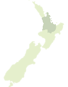

Scroll down to see a more detailed road map and below that a topographical map showing the location of Umangawha Stream. The road map has been supplied by openstreetmap and the topographical map of Umangawha Stream has been supplied by Land Information New Zealand (LINZ).

Yes you can use the top static map for you school/university project or personal website with a link back. Contact me for any commercial use.

Umangawha Stream Map New Zealand


New Zealand places in our database
[ A ] [ B ] [ C ] [ D ] [ E ] [ F ] [ G ] [ H ] [ I ] [ J ] [ K ] [ L ] [ M ] [ N ] [ O ] [ P ] [ Q ] [ R ] [ S ] [ T ] [ U ] [ V ] [ W ] [ X ] [ Y ] [ Z ]


Closest 20 Streams to Umangawha Stream

Ngakuku Stream ( 1.46km )   Kairaumati Stream ( 1.7km )   Tukituki Stream ( 2.45km )   Wairore Stream ( 2.93km )   Waikerere Stream ( 3.04km )   Maurea Stream ( 3.38km )   Waikanae Stream ( 3.46km )   Tatahoa Stream ( 3.62km )   Mataiterangi Stream ( 4.18km )   Waitete Stream ( 4.2km )   Wharetaua Stream ( 4.32km )   Tawhetarangi Stream ( 4.79km )   Gisborne Stream ( 4.88km )   Ahirau Stream ( 4.92km )   Whareroa Stream ( 5.14km )   Mangatu Stream ( 5.19km )   Matamataharakeke Stream ( 6.05km )   Huakitoetoe Stream ( 6.29km )   Waikawau River ( 6.42km )   Wairakau Stream ( 6.71km )   Tuateawa Stream ( 6.99km )   Omoho Stream ( 7.12km )   Ngamoko Stream ( 7.15km )   Waiaro Stream ( 7.34km )   Taiharuru Stream ( 7.83km )   Haunoni Stream ( 8km )   Rautawhake Stream ( 8.05km )   Rauporoa Stream ( 8.4km )   Okiore Stream ( 8.62km )   Urarima Stream ( 8.73km )   Kopurukaitai Stream ( 8.87km )   Waihirere Stream ( 8.87km )   Pakore Stream ( 9.1km )   Harataunga Stream ( 9.48km )   Waiwhango River ( 9.71km )   Tangiaro Stream ( 9.92km )   Awaroa Stream ( 10.28km )   Hope Stream ( 10.49km )   Waikoromiko Stream ( 10.67km )   Driving Creek ( 10.71km )