Map showing location of Tutaeariari Stream


LINZ description: Feature shown on: NZMS260 Q20 Edition 1 1987
Latitude: -39.455556
Longitude: 174.464611
Northing: 5631644.4
Easting: 1726008.7
Land District: Taranaki
Feat Type: Stream
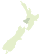

Scroll down to see a more detailed road map and below that a topographical map showing the location of Tutaeariari Stream. The road map has been supplied by openstreetmap and the topographical map of Tutaeariari Stream has been supplied by Land Information New Zealand (LINZ).

Yes you can use the top static map for you school/university project or personal website with a link back. Contact me for any commercial use.

Tutaeariari Stream Map New Zealand


New Zealand places in our database
[ A ] [ B ] [ C ] [ D ] [ E ] [ F ] [ G ] [ H ] [ I ] [ J ] [ K ] [ L ] [ M ] [ N ] [ O ] [ P ] [ Q ] [ R ] [ S ] [ T ] [ U ] [ V ] [ W ] [ X ] [ Y ] [ Z ]


Closest 20 Streams to Tutaeariari Stream

Otauira Stream ( 3.1km )   Makino Stream ( 3.29km )   Hauha Stream ( 3.41km )   Aorere Stream ( 3.57km )   Mangatoromiro Stream ( 4.11km )   Mangamingi Stream ( 4.93km )   Rahui Stream ( 5.56km )   Mangakotuku Stream ( 5.77km )   Patete Stream ( 5.94km )   Maruarau Stream ( 7.23km )   Upokorau Stream ( 7.62km )   Kaitangi Stream ( 7.75km )   Ararata Stream ( 7.79km )   Pleasant Stream ( 7.94km )   Makaria Stream ( 8.23km )   Whenuakura River ( 8.86km )   Mangaehu Stream ( 9.34km )   Katatuna Stream ( 9.44km )   Pine Stream ( 10.28km )   Kiritae Stream ( 10.64km )   Makuri Stream ( 10.8km )   Mangemange Stream ( 10.93km )   Mangimangi Stream ( 10.93km )   Tauwharenikau Stream ( 11.48km )   Waihapa Stream ( 11.63km )   Mangarata Stream ( 11.67km )   Okirau Stream ( 11.9km )   Tahunamaere Stream ( 12.15km )   Upokorau Stream ( 13.54km )   Ngaere Stream ( 13.75km )   Tangarata Stream ( 13.96km )   Tawhiti Stream ( 14.12km )   Pipi Stream ( 14.45km )   Kuranui Stream ( 14.84km )   Toko Stream ( 14.87km )   Poroporo Stream ( 15km )   Mangaone Stream ( 15.04km )   Puiatoe Stream ( 15.29km )   Tahuna Stream ( 15.39km )   Katoke Stream ( 15.68km )