Map showing location of Tahenga-a-whenua Mountain


LINZ description: 16km north-east from Te Karaka (locality). Height: 285m
Latitude: -38.335617
Longitude: 177.957618
Northing: 5745300
Easting: 2033400
Land District: Gisborne
Feat Type: Hill
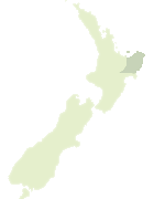

Scroll down to see a more detailed road map and below that a topographical map showing the location of Tahenga-a-whenua Mountain. The road map has been supplied by openstreetmap and the topographical map of Tahenga-a-whenua Mountain has been supplied by Land Information New Zealand (LINZ).

Yes you can use the top static map for you school/university project or personal website with a link back. Contact me for any commercial use.

Tahenga-a-whenua Mountain Map New Zealand


New Zealand places in our database
[ A ] [ B ] [ C ] [ D ] [ E ] [ F ] [ G ] [ H ] [ I ] [ J ] [ K ] [ L ] [ M ] [ N ] [ O ] [ P ] [ Q ] [ R ] [ S ] [ T ] [ U ] [ V ] [ W ] [ X ] [ Y ] [ Z ]


Closest 20 Hills to Tahenga-a-whenua Mountain

Toromiro ( 3.75km )   Pyramid ( 5.35km )   Arakihi ( 8.16km )   Pukerua ( 8.51km )   Rangirewa ( 9.81km )   Ruamaere ( 10.11km )   Ahioteatua ( 10.89km )   Paraheka ( 11.41km )   Tatai ( 11.5km )   Rangatira ( 11.92km )   Wheturau ( 12.68km )   Ahititi ( 13km )   Rakaukaka ( 13.46km )   Te Rimu ( 14.33km )   Pukenohi ( 14.53km )   Ngauotekaka ( 14.98km )   Makiri ( 15.74km )   Kiorekaitarahore ( 16.27km )   Kaiwinika ( 16.33km )   Pukenene ( 17.29km )   Kainaonao ( 18.65km )   Pukematai ( 18.72km )   Tirohanga ( 18.72km )   Te Kapua ( 18.77km )   Rakurakutara ( 19.3km )   Mangamaunu ( 19.71km )   Te Patukoura ( 19.79km )   Kereruhuahua ( 20.3km )   Te Kaho ( 20.55km )   Tikihore ( 20.75km )   Omarutipi ( 20.82km )   Waikohu ( 21.65km )   Puakato ( 21.9km )   The Dome ( 21.96km )   Tiritiri ( 21.98km )   Ngapopohia ( 22.32km )   Pukerewa ( 22.58km )   Puketahore ( 22.88km )   Kopaatuaki ( 23.01km )   Kopua a Tuaki ( 23.01km )