Map showing location of Pahaheke Stream


LINZ description: Feature shown on: NZMS260 T24 Edition 1 1980
Latitude: -40.386694
Longitude: 175.999944
Northing: 5525000.4
Easting: 1854642.9
Land District: Hawke's Bay, Wellington
Feat Type: Stream
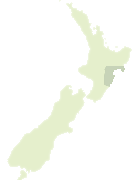

Scroll down to see a more detailed road map and below that a topographical map showing the location of Pahaheke Stream. The road map has been supplied by openstreetmap and the topographical map of Pahaheke Stream has been supplied by Land Information New Zealand (LINZ).

Yes you can use the top static map for you school/university project or personal website with a link back. Contact me for any commercial use.

Pahaheke Stream Map New Zealand


New Zealand places in our database
[ A ] [ B ] [ C ] [ D ] [ E ] [ F ] [ G ] [ H ] [ I ] [ J ] [ K ] [ L ] [ M ] [ N ] [ O ] [ P ] [ Q ] [ R ] [ S ] [ T ] [ U ] [ V ] [ W ] [ X ] [ Y ] [ Z ]


Closest 20 Streams to Pahaheke Stream

Makairo Stream ( 2.94km )   Nikau Stream ( 3.24km )   Miro Stream ( 3.96km )   Maroa Stream ( 4.31km )   Awapikopiko Stream ( 4.31km )   Totara Stream ( 4.4km )   Mahoui Stream ( 5.44km )   Waitakotorua Stream ( 5.6km )   Otawhao Stream ( 6.43km )   Otope Stream ( 9.72km )   Otopae Stream ( 9.72km )   Mangatoro Stream ( 10.19km )   Pukengaio Stream ( 11.58km )   Makuriiti Stream ( 11.86km )   Ngaturi Creek ( 12.29km )   Raparapawai Stream ( 12.89km )   Mangapapa Stream ( 13.33km )   Tiraumea River ( 13.49km )   Papahua Stream ( 14.68km )   Waihatuara Stream ( 15.27km )   Makuri River ( 15.33km )   Tauwhareweru Stream ( 15.43km )   Makuri Stream ( 15.71km )   Waipuehu Stream ( 16.04km )   Kaitawa Creek ( 16.84km )   Oporae Stream ( 16.99km )   Mangaatua Stream ( 17.57km )   Mangakokako Stream ( 17.6km )   Waitahora Stream ( 18.39km )   Mangatakoto Stream ( 18.47km )   Kotarenui Stream ( 18.58km )   Coppermine Stream ( 18.64km )   Mangatera Stream ( 18.92km )   Korora Stream ( 18.96km )   Mangaramarama Creek ( 18.98km )   Makahikatea Creek ( 19.73km )   Packtrack Stream ( 19.74km )   Ongaha Stream ( 19.82km )   Makirikiri Stream ( 20.73km )   Tokitoki Stream ( 20.93km )