Map showing location of Opepe Bush Scenic & Historic Reserve


LINZ description: No details provided by OTS and DOC
Latitude: -38.766111
Longitude: 176.22
Northing: 5704252.4
Easting: 1879773.2
Land District: South Auckland
Feat Type: Historic Reserve
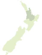

Scroll down to see a more detailed road map and below that a topographical map showing the location of Opepe Bush Scenic & Historic Reserve. The road map has been supplied by openstreetmap and the topographical map of Opepe Bush Scenic & Historic Reserve has been supplied by Land Information New Zealand (LINZ).

Yes you can use the top static map for you school/university project or personal website with a link back. Contact me for any commercial use.

Opepe Bush Scenic & Historic Reserve Map New Zealand


New Zealand places in our database
[ A ] [ B ] [ C ] [ D ] [ E ] [ F ] [ G ] [ H ] [ I ] [ J ] [ K ] [ L ] [ M ] [ N ] [ O ] [ P ] [ Q ] [ R ] [ S ] [ T ] [ U ] [ V ] [ W ] [ X ] [ Y ] [ Z ]


Closest 20 Historic Reserves to Opepe Bush Scenic & Historic Reserve

Fort Galatea Historic Reserve ( 60.35km )   Te Heru o T?reia Historic Reserve ( 64.14km )   Tiwaewae Memorial Reserve Historic Reserve ( 77.05km )   Heipipi Pa Historic Reserve ( 91.1km )   Tikirere Mill Race Historic Reserve ( 97.98km )   Otatara Pa Historic Reserve ( 101.52km )   Maungaruahine Pa Historic Reserve ( 102.49km )   Puketapu Historic Reserve ( 102.72km )   Matekerepu Historic Reserve ( 111.51km )   Paparoa Pa Historic Reserve ( 114.05km )   Selwyn Park Historic Reserve ( 114.65km )   Kakepuku Mountain Historic Reserve ( 114.68km )   Tokitoki Historic Reserve ( 116.48km )   Gate Pa Historic Reserve ( 116.87km )   Gudex Memorial Park Historic Reserve ( 117.04km )   Hine Rae Historic Reserve ( 119.02km )   Waiotahe Spit Historic Reserve ( 121.46km )   Waiotahi Spit Historic Reserve ( 121.46km )   Paterangi Historic Reserve ( 124.53km )   Gerald Crapp Historic Reserve ( 127.45km )   Kawau Pa Historic Reserve ( 140.45km )   Pou Tehia Historic Reserve ( 140.85km )   Kauri Point Historic Reserve ( 141.03km )   Puraho Historic Reserve ( 148.12km )   Young Nick's Head/Te Kuri a Paoa Historic Reserve ( 150.86km )   Te Kuri a Paoa / Young Nick’s Head National Historic Reserve ( 150.86km )   Whangawehi Coronation Reserve ( 154.13km )   Victoria Battery Historic Reserve ( 155.44km )   Cook Landing Site Historic Reserve ( 156.94km )   Moutoa Gardens Historic Reserve ( 163.7km )   Awa te Take Pa Historic Reserve ( 170.61km )   Taniwha Pa Historic Reserve ( 170.81km )   Pukerangiora Pa Historic Reserve ( 172.47km )   Puketakauere Pa Historic Reserve ( 174.46km )   Te Wheoro's Redoubt Historic Reserve ( 176.44km )   Rangiriri Pa Historic Reserve ( 176.78km )   Mahoetahi Historic Reserve ( 177.56km )   Sentry Hill Redoubt Historic Reserve ( 177.69km )   Taumata Historic Reserve ( 179.93km )   Smith Historic Reserve ( 186.46km )