Map showing location of North West Bay


LINZ description: Feature shown on: NZMS260 O26 P25 Pt P26 Edition 1 1980; NZTopo50-BP28 744507
Latitude: -41.091361
Longitude: 173.8855
Northing: 5450723.2
Easting: 1674369.4
Land District: Marlborough
Feat Type: Bay
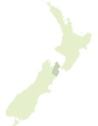

Scroll down to see a more detailed road map and below that a topographical map showing the location of North West Bay. The road map has been supplied by openstreetmap and the topographical map of North West Bay has been supplied by Land Information New Zealand (LINZ).

Yes you can use the top static map for you school/university project or personal website with a link back. Contact me for any commercial use.

North West Bay Map New Zealand


New Zealand places in our database
[ A ] [ B ] [ C ] [ D ] [ E ] [ F ] [ G ] [ H ] [ I ] [ J ] [ K ] [ L ] [ M ] [ N ] [ O ] [ P ] [ Q ] [ R ] [ S ] [ T ] [ U ] [ V ] [ W ] [ X ] [ Y ] [ Z ]


Closest 20 Bays to North West Bay

Miro Bay ( 1.55km )   Tiraora Bay ( 1.55km )   Pelorus Sound ( 2.02km )   Pelorus Sound / Te Hoiere ( 2.02km )   Tamuakawawe Bay ( 2.09km )   Jacobs Bay ( 2.14km )   Wilson Bay ( 2.93km )   Shag Cove ( 3.44km )   Fairy Bay ( 3.49km )   South East Bay ( 3.94km )   Yncyca Bay ( 4.33km )   Brightlands Bay ( 4.39km )   Marys Bay ( 4.81km )   Tawa Bay ( 6.16km )   Penguin Bay ( 6.64km )   Old Homewood Bay ( 6.68km )   Four Fathom Bay ( 6.74km )   Godsiff Bay (Matai) ( 7.07km )   Tennyson Inlet ( 7.42km )   Chance Bay ( 7.76km )   Tawhitinui Bay ( 7.82km )   Crail Bay ( 7.84km )   Wet Inlet ( 8.48km )   Horseshoe Bay ( 8.48km )   Bucklands Bay ( 8.57km )   Hopai Bay ( 8.63km )   Nikau Bay ( 8.67km )   Ng?whakawhiti Bay ( 8.78km )   Picnic Bay ( 9.2km )   Deep Bay ( 9.39km )   Kauauroa Bay ( 9.42km )   M?ori Bay ( 9.56km )   Elie Bay ( 9.56km )   Woodlands Bay ( 9.8km )   Deep Bay ( 9.8km )   Waiona Bay ( 9.8km )   Penzance Bay ( 9.83km )   Manx Cove ( 9.97km )   Te Mako Bay ( 9.99km )   Grant Bay ( 10.07km )