Tablelands
Quick Facts
- Distance: 20 km
- Time: 2-3 days
- Grade: Easy
- Higest point: 1500m
- Island: South
- Location: Kahurangi National Park
- Map: Mt Arthur M27

The access road to Flora Car park is a narrow gravel road and at times steep. I have never had a problem getting my 2 wheel drive car up there though.
Flora Car Park - Flora Hut: 2 km - 30 minutes
The walk to Flora Hut (12 bunks) is very easy to say the least and is in a good position if you have arrived late in the afternoon. On the way to the hut you will come across side tracks that head up to Mt Arthur and Mt Lodestone, I will cover Mt Arthur separately.
Flora Hut - Gridiron Rock Shelter: 4 km - 1 1/2 Hours
The track starts of by following a vehicle track and after 1 hour you will come to a side track that leads to Gordon's Pyramid and Gloustons Mine, it was pouring down when we did this section of track so we flagged the 6 km return walk that heads above bush line.
Following the vehicle track for another 1 km you will come to a track that winds up to the first of the rock shelters, this is in fact a small romantic hut nestled underneath a rock overhang, it has a swing chair in front of a open fire and a small pot belly stove inside. A couple of minutes down the track you will come to the impressive rock overhang known as Gridiron Rock Shelter.

Keep a eye on the track and be careful not to stand on the Powelliphanta Land Snails that are common in this area, these large snails are protected and you are not allowed to take even the empty shells. Don't!
After leaving Gridiron Rock Shelter the track follows Flora Steam for 2 km's where you will come to upper junction, the track on your right leads down to Takaka River, Bullock Track and Asbestos Cottage (DOC). It's another 1 km till you come to the third of the rock shelters known as Growler Rock Shelter, this is a small shelter although it can sleep 2 it is more of a lunch stop.
The track then gradually climbs over a 2 km distance above the bush line. After about 1 hour you will come to a track on your left hand side that leads to Dry Rock Shelter 10 bunks, we were going to sleep here the night but just as we got a nice roaring fire going and put the billy on a group of about 15 people arrived that were doing a guided hike and took over the place.
After passing the intersection with Dry Rock Shelter it's 1 km of easy travel to Salisbury Hut, this serviced 24 bunk hut is modern and has gas heaters and cookers.
Salisbury Lodge - Balloon Hut: 4 km - 2 Hrs
Behind Salisbury Hut the track climbs up through a short section of bush to Starvation Ridge and into the expansive open country known as the Tablelands. After 2 km there is another fork in the track, the track on your left is part of the Leslie Track. Continue along through the open tussock country for 2 km and you will come to Balloon Hut (14 bunks, serviced).
 Balloon Hut - Lake Peel: 5.5 km - 2 1/2 hours return
We did this section as a side trip, from Lake Peel you could walk 3 km down into Cobb Reservoir and the road end or to Asbestos Cottage and lower Junction.
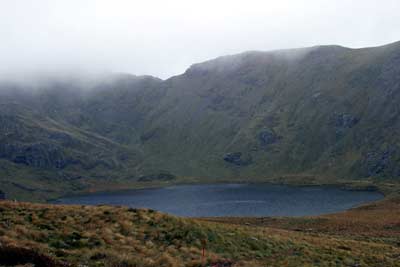
From Balloon Hut the track steadily climbs up to the ridge on Peel Range (1500 m) then follows a warn out track around some rock outcrops to Lake Peel.