Stewart Island North West Circuit Track
Quick Facts
- Distance: 120 km
- Time: 8 - 10 days
- Grade: Medium
- Higest point: 350 m
- Island: Stewart
- Location: Stewart Island
- Map: Halfmoon Bay D48 / E48 / F48
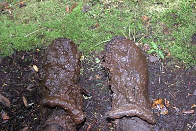
Make sure you are well equipped with waterproofs (it rains 275 days of the year) and be prepared to slog up and down slippery gullies, through mud (in some cases knee deep) and over a generally rough track of roots. Don't underestimate this one and keep smiling.
Times: Oban - Oban: 8 - 10 days
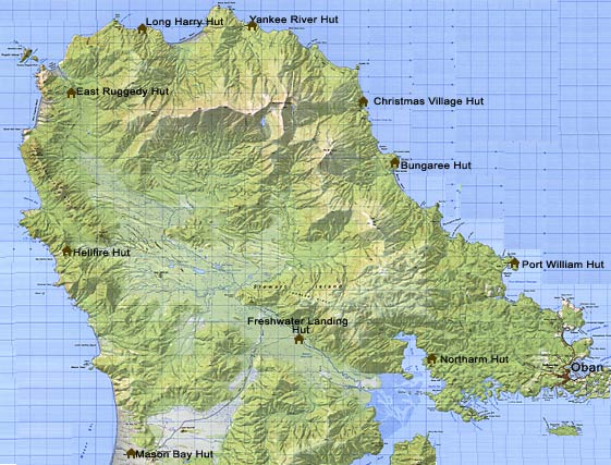
Oban - Port William Hut: 12km, 4hrs
We saved about a hour by catching a shuttle to Lee Bay which costs $20 and takes up to 4 people (across the road from the DOC office) this allowed us to skip Port William hut and head straight for Bungaree. Everyone we talked to wished they had done the same, as the walk of 5 km or so along the road isn't very exciting.
The track starts off by following the coast to Little River and Maori Beach (a former sawmill settlement). At the north end of the beach you will come across a swing bridge, cross this and head up the small hill. After 15 minutes or so you will come to a fork in the track, head straight ahead as the track on your left is part of the Rakiura Track. Follow Magnetic Beach around and in about 20 minutes you will come to Port William Hut (great walk hut) 30 bunks.
Port William Hut - Bungaree Hut: 6 km, 3 - 4 hrs
This section of the track is mostly through forest and you will get your first taste of the infamous Stewart Island mud. After slogging your way for about 3 km the track comes to a footbridge, bypasses Little Bungaree Beach and comes to a headland. Cross over the headland and you will come to Big Bungaree Beach. Follow this pretty beach for about 20 minutes and you will come to the 20 bunk hut. There is a small bay around the corner which looks like a perfect place to have a dip.
Bungaree Hut - Christmas Village Hut: 11.5 km, 6 hr
The track heads inland crossing a few gullies for about 1-2 hours to Murray Beach. Follow this golden sandy beach for 2 km and just before the end of it you will see the track heading inland. The track then crosses a swing bridge over the Murray River. Just over the bridge you will come to a side track, this leads to an old steam engine. The track then crosses more gullies and streams for 3 km and you see very little of the coastline. You will then come to a junction in the track and the short walk leads down to Christmas Village Hut (16 bunks). The hut is located on a bank above the rocky beach.
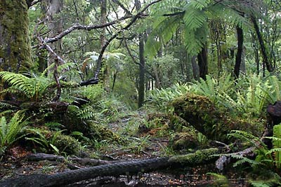
The track starts of heading up a steep hill and you will come to a junction to Mt Anglem. We didn't do this side trip as it was raining and there would of been little chance of any decent views, its 6 - 8 hours return to Mt Anglem, the highest point on Stewart Island at 980 metres. From the junction of Mt Anglem it is 5 km of dry and easy going travel through tall rimu's till the decent into Lucky Beach. Follow this rocky beach for 500 meters over some boulders till you see the track heading up a steep hill, the track is easy to miss so if you find yourself heading around the headland you have gone to far. Once at the top of the hill the track then follows undulating country to the brown stained Yankee River. Follow the river down for 5 minutes till you get to Yankee River Hut (20 bunks).
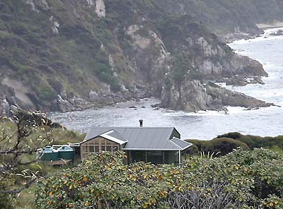
Note:Long Harry Hut has been moved it is now closer to Yankee River Hut than old maps show.
Head back up the track till the junction then up the fairly steep headland for 200 meters. It is a easy walk for 1 km till the track decends into the impressive sand dunes of Smoky Beach. At the other end of the beach you will see the track across Smoky River, there is a footbridge further up but we found it easier to just cross the river. The track then climbs steeply for 1 km or so. Once at the top the track flattens out for about 1 km until you come to a clearing and see the new Long Harry Hut. The track then heads down and around to the other side of the hut and what seemed like a gentle 5 minute walk to the hut turns out to be a 20 minute detour.
The new Long Harry Hut is in a superb location and thumbs up to DOC for moving it there. If I ever do this track again I would spend a extra night there and spend the day fishing or looking for yellow eyed penguins.
Long Harry Hut - East Ruggedy Hut: 11 km, 6 hr
The track heads up behind Long Harry Hut for 500 meters then crosses several gullies for about 1.5 km, some of these gullies are very slippery so take care. The track then heads inland for 2 km and drops down into a coastline of boulders, follow this coastline for 1 km. The track the steadily climbs for 2 km till you come to a lookout that offers superb views of the Rugged Island and East Ruggedy Beach. The track then drops down into Ruggedy Stream, follow the buoys over the golden sand for about 1 km and you will come to East Ruggedy Hut "The Ritz", this lovely cabin style hut has 16 bunks.
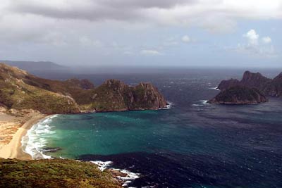
This section has been recently changed. The new track now heads down from Ruggedy Hut to West Ruggedy Beach, and this is another job well done by DOC. Golden sands, untouched bush and the Rugged Range as a backdrop make this one of the nicest beaches that I have come across. It's about 1.5 km down to East Ruggedy Beach from the hut and another 1.5 km stroll along the beach. The track then winds its way up for about 2 km till it flattens out. It then gently climbs for 2 km to the 250 m pass and down into Waituna Bay. The next 3.5 km would have to be the most deceiving section of track that I have come across. From the remote Waituna Bay the track gently climbs for 2 km. Then MUD and lots of it, for the remaining 1.5 km we were literally walking knee deep in it! It took at least 2 hours to complete this relativity short section, talk about stuffed. We finally arrived to Hellfire Pass Hut (16 bunks) which has awesome views looking out over the Ruggedy Flats. Someone left a potato at this hut, we presumed it was DoC workers, it was like finding gold and perhaps the best thing I have ever eaten as we had some butter, salt and tin foil. I will remember that potato till the day I die :) Hellfire Pass Hut - Mason Bay Hut: 15 km, 7 hr
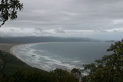
The track starts off by climbing up through the bush for 1.5 km (we saw 2 kiwi in a Manuka patch at about 6am). Then it follows the ridge around for another 2 km, occasionally opening up to provide some good views before dropping down into Little Hellfire Beach. It's 1 km along the beach until the track then steadily heads up to the top of the headland where you will get your first view of Mason Bay. The track the drops steeply into Mason Bay and follows the beach for 4.5 km to the buoys marking the way (1 km) to Mason Bay Hut 24 bunks. If you are feeling fit you can walk to the other end of Mason Bay to the Gutter and the Earnest Islands (20 km return).
Mason Bay Hut - Freshwater Landing Hut: 14 km, 3 hr - 4 hr
This section is the easiest leg of the track. It starts of by following a old vehicle track (remnants of a old farm) through open country and stands of Manuka. It can apparently get quite flooded through here and there are large sections of boardwalks through the more swampy areas. We never noticed it but some other trampers we met were quite perplexed by the stream along side the track, it apparently gives an illusion of flowing uphill. The last 2 km gets a bit monotonous and Freshwater Hut will be a welcome site (12 bunks) you can get a water taxi from here to Oban by booking it before hand.
Freshwater Landing Hut - North Arm Hut: 11 km, 6 hr - 7 hr
Every guide book and pamphlet we read said that this is the hardest section and very challenging, I would disagree. Although if it was pouring down I could imagine it gets quite treacherous. The first 2 km the track gently climbs up to a river, then it is a short but steep ascent to Thompson Ridge. Then it just as steeply drops down and follows several bays around to the joining of the Rakiura Track. The last 1 km to the North Arm Hut (great walk - 30 bunks) is a breeze and like us you might find yourself running on the very well graded track.
North Arm Hut - Halfmoon Bay: 12 km, 4 hr
This section of the track is also part of the Rakiura Track and being a great walk is well graded. It starts of by heading over a few headlands and after 2 km drops down into Sawdust Bay. It then climbs up and over a small saddle and sidles around a couple more bays although you see very little of the coastline. It is then a straight forward 2 hour walk inland to Oban for a well deserved pint and a decent feed.
