Stafford Bay Track
Quick Facts
- Distance: 16 km
- Time: 2 days
- Grade: Moderate
- Higest point: 243 m
- Island: South
- Location: Westland
- Map: Cascade E37 / E38

The route requires some navigation skills as parts of it are unmarked and a map should be carried. There are numerous river crossings and at times we were walking straight down the guts of a creek. So this isn't one you want to be doing during or after heavy rain.
The track starts 500m before the fishing community of Jackson Bay which is 50 km's south of the main highway from Haast (as far as you can go south on the West Coast of the South Island). The township has no supplies but there is a mobile fish n chip shop parked up.
Times: Jackson Bay - Stafford Hut: 4 - 5 hours.
Jackson Bay - Smoothwater River: 45 minutes.
Easy and well marked travel
Smoothwater River - Stafford Saddle: 1 1/2 - 2 hours.
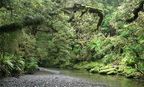
After following Soothwater River upstream for about 20 minutes you will come to the confluence with Kakapo Stream. The track then zig-zags up Kakapo Creek for about a hour where the track then climbs up to the saddle.
Stafford Saddle - Stafford Hut: 1 1/2 - 2 hours.
The track sidles around the hill and then drops down into a Creek from here on the track is mostly unmarked. We simply followed this creek all the way down till it met with Stafford River. From here on in it is mostly just following Stafford River downstream keeping a eye out for the orange markers until you reach the hut (on the true left of the river, 6 bunks).
Returning
There are two ways to get back, you can either back track the next day or do what we did and follow the coast around.

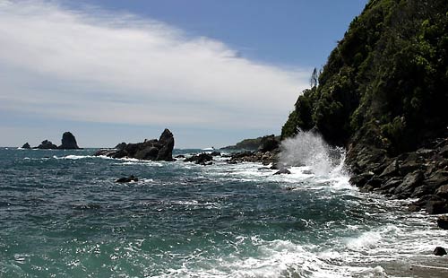
You must leave the hut at least a hour before low tide or low tide if doing it the other way or be prepared to wait 4 hours or so for the tide to go down. It can only be done if the sea is calm and in this part of the world the seas can be very rough. You can get tide times at the Haast visitors centre.
Follow Stafford River downstream for about 10 minutes till you get to Stafford Bay. The track starts of by following a couple of lovely sandy beaches. After a hour or so the coastline becomes increasingly rocky, look out for the markers/bouys as there are shortcuts over a few of the headlands until you get to Homminy Bay. From here on in it gets a bit on the dodgy side, keep a eye on the tide if it is rising and looks like it is almost high tide stay put! Once you get to Smoothwater bay cross Smoothwater River where you can, and follow it till it rejoins the main track.