Bull Mound : Quoin Ridge
Bull Mound / Quoin Ridge Quick Facts
- Time: 2 - 3 days
- Grade: Medium / Fit (navigation skills required)
- Island: North
- Location: Tararua Forest Park
- Map: Carterton S26 / 1:50,000 Tararua Map
Heading from near Palmerston North to the capital, the Tararua Forest Park offers many weekend tramping opportunities, though the wild winds that strike this part of the country are a constant threat. The open tops provide vistas stretching from the Wairarapa to the Kapiti Coast and south to Wellington Harbour. The track and hut network is extensive, created both by the old forest service and the volunteer efforts of the many active tramping clubs in the area.
Kaitoke to Smiths Creek Shelter (2-2.5 hrs)
Kaitoke is only a short drive from Upper Hutt and the two road-ends here (4 km apart) form the start and finish of this trip. If possible arrange for a shuttle of cars to the other car park to avoid a road walk at the conclusion of the trip. To find your way to the start, leave Upper Hutt for the Wairarapa and turn left into Marchant Road. The walk to Smiths Creek is an ideal start to the trip on a Friday evening, enabling the route to be comfortably tackled in a normal weekend. Beginning across the river, the track starts at a large car park, where cars may not be safe from vandals. If leaving a car, it is advisable to check at nearby Kiwi Ranch, who normally allow parking for a nominal fee (the is a connecting track from here). The well graded track heads up at a steady gradient passing the turnoff to the boring Marchant Ridge to reach the Puffer Saddle. While still well below the bushline, some views are achieved en route and at the saddle. Descending down the track is initially well graded before it turns to a more standard basic track at the valley floor. A recent slip now requires a detour up and down that is well marked. Arriving at the concrete block, Smiths Creek shelter, its gloomy appearance may not be too inviting but is welcome sight on a wet evening. Good camping is available only a few minutes up the track.
Smiths Creek to Tutuwai Hut (2 - 3 hrs)
Leaving the shelter, the track follows up the true right of the valley, both in the bush and adjacent to some grassy flats that offer lovely campsites. The Tauherenikau River babbles its way down and it is crossed by a large new swing bridge. Stepping to the other side, there are substantial river flats that offer a lovely spot for a break in fine weather. Approximately 30 minutes past the bridge up on a terrace sits Tutuwai Hut, 20 bunks and gas cookers. It's a nice spot to spend the night if having started from the car park in the morning and completing the trip over 3 days.

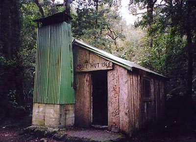
The route to Cone hut follows the valley floor on the true left. Never difficult, it pops in and out of grassy clearings before the turnoff to Bull Mound. Only a few minutes past the turnoff lies the historic Cone Hut. Built by bush carpenters from the Tararua Tramping Club, the hut is made out of large slabs of Totara and sits in a very small clearing. Gloomy and with a dirt floor, its an interesting spot to visit, but a less than appealing spot for the night.
Cone Hut to Alpha Hut, via Bull Mound (3.5-4.5 hrs)
Back at the junction the track immediately crosses the river, a crossing that is simple in normal flow, but will cause problems following heavy rain. The track is basic and very steep - a gut busting climb, though the altitude is gained quickly. Breaking out of the bush pleasant views are afforded in all directions. Bull Mound is a lovely spot, it fragile environment dotted with tarns and covered in mosses. Following Bull Mound the track heads back into the bush to meet the Southern Crossing track and the frustrating Hells Gate. A steep descent of almost 200 metres is followed by an equally steep climb to regain the height and then soon after, more climbing up to Alpha Hut, sitting just beneath the bushline. The 20-bunk hut offers limited views but is a nice spot to spend the evening.
Alpha Hut to Alpha Peak (30-40 minutes)
Rising from the hut, the track heads through the bush for 10 minutes or so, before popping onto the open tussock slopes on Alpha. The walk to the peak of Alpha is straightforward. At this point the track of the Southern Crossing heads straight ahead, but the route back to Kaitoke turns left and heads southwest along Quoin Ridge.

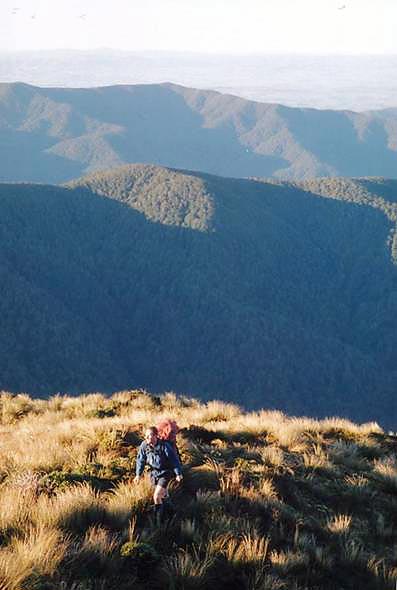
Of the three ways to end a Southern Crossing, Quoin Ridge is the least used, yet the most spectacular. While most people head out via Marchant Ridge, Quoin is the jewel in the crown of the southern Tararuas. From about 1950 to the late 1990's this area was out of bounds as restrictions on water catchment areas were stricter. Now, people are welcome to tramp through the water catchment area, but overnight stops are not permitted. There is no track along Quoin Ridge but there is a trodden path developing as more people begin to discover this route. The route follows the ridge the whole way down to Hutt Forks, for some time this is above the bushline offering views down valley into Wellington harbour. Upon hitting the bushline, more care needs to be taken, but keeping to the main ridge is the trick. A lovely clearing, which acts as an ideal lunch spot, appears after a while. From this clearing the route is in bush to the Hutt Forks, with the last section marked, but poorly marked. If you lose the markers at the end, don't despair, just head down and the track will be picked up along the Eastern Hutt River. Follow the river upstream for 15 minutes to the swingbridge, and after crossing the bridge the track heads downstream for 5 minutes before turning left away from the river. After another 5-10 minutes, the track becomes a 4WD track, which offers an uphill slog of 300 metres, followed by a similar sized decent to the car park near the Kaitoke rangers house.
It's a 4km walk trip around to the other car park on the road, if you haven't managed a car shuttle.