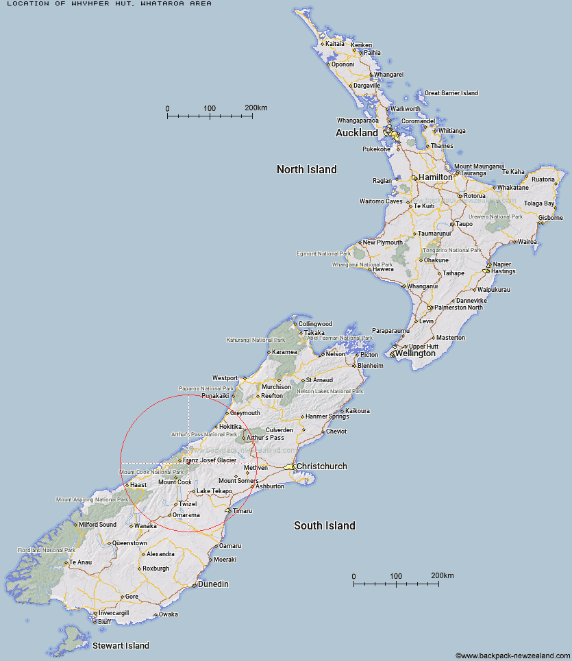
Topo Map showing location of Whymper Hut
This information is sourced from DoC, LINZ and Openstreetmap. Some of the hut photos are mine and the rest are from DoC. I will be adding an upload feature soon so people can photos of .Whymper Hut.
Basic info: standard six-bunk hut in the Glaciers area.
Latitude: -43.4420239178
Longitude: 170.371543245
Location: Whataroa area
Area: West Coast
Type of Hut: Standard
Tracks: Whataroa, Butler and Perth valleys tracks
Map: BX16 Topo Map | Road Map
Does this hut still exist? Have any more information? Contact
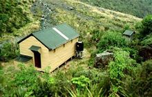
Image: DoC
Scroll down to see a topographical map and road map showing the location of Whymper Hut
[ A ] [ B ] [ C ] [ D ] [ E ] [ F ] [ G ] [ H ] [ I ] [ J ] [ K ] [ L ] [ M ] [ N ] [ O ] [ P ] [ Q ] [ R ] [ S ] [ T ] [ U ] [ V ] [ W ] [ Y ] [ Z ]
Closest 20 Huts to Whymper Hut
These are as the crow fliesButler Junction Hut 5.15km Top Butler Hut 6.06km Spencer Rock Bivouac 8.23km Tasman Saddle Hut 8.33km Kelman Hut 8.63km Murchison Hut 8.7km Stan's Hut 9.95km Godley Hut 11.99km Eade Memorial Hut 12.38km Centennial Hut 13.32km Almer Hut 13.65km Nolans Hut 13.71km Red Stag Hut 15.19km Hende's Hut 15.68km Castle Rocks Hut 16.56km Scone Hut 17.59km Pioneer Hut 18.17km Onslow Hut (Steffan Memorial Hut) 19.33km Rankin Hut 19.71km Haast Hut 21.07km Liebig Hut 21.34km Plateau Hut 21.83km Forbes Bivouac 22.47km Chancellor Hut 22.54km Macaulay Hut 24.22km Carneys Bivvy's 24.24km Murphys Bivvy 24.85km Ball Hut 25km Angus Hut 25.05km Saint Winifreds Hut 25.31km Mistake Flats Hut 26.02km Memorial Hut 26.23km Empress Hut 26.34km Birdcage Hut 26.69km Caroline Hut 26.94km Curtis Memorial Hut 27.54km Growler Hut 30.6km Ribbonwood Hut 31.44km Stony Stream Hut 31.81km Copland Shelter 32.33km