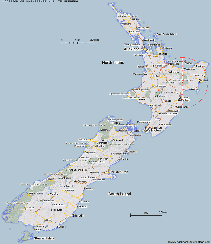
Topo Map showing location of Whakatakaa Hut
This information is sourced from DoC, LINZ and Openstreetmap. Some of the hut photos are mine and the rest are from DoC. I will be adding an upload feature soon so people can photos of .Whakatakaa Hut.
Basic info: standard six-bunk hut in the Te Urewera area.
Latitude: -38.6924591678
Longitude: 177.001454198
Location: Te Urewera
Area: East Coast
Type of Hut: Standard
Map: BG40 Topo Map | Road Map
Does this hut still exist? Have any more information? Contact
Basic info: standard six-bunk hut in the Te Urewera area.
Latitude: -38.6924591678
Longitude: 177.001454198
Location: Te Urewera
Area: East Coast
Type of Hut: Standard
Map: BG40 Topo Map | Road Map
Does this hut still exist? Have any more information? Contact
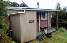
Image: DoC
Scroll down to see a topographical map and road map showing the location of Whakatakaa Hut
[ A ] [ B ] [ C ] [ D ] [ E ] [ F ] [ G ] [ H ] [ I ] [ J ] [ K ] [ L ] [ M ] [ N ] [ O ] [ P ] [ Q ] [ R ] [ S ] [ T ] [ U ] [ V ] [ W ] [ Y ] [ Z ]
Closest 20 Huts to Whakatakaa Hut
These are as the crow fliesWhanganui Hut 4.6km Waiharuru Hut 6.3km Marauiti Hut 8.37km Kanohirua Hut 10.2km Manuoha Hut 11.12km Te Totara Hut 11.89km Waiopaoa Hut 12.97km Panekire Hut 14.04km Waiawa Hut 14.71km Central Waiau Hut 15.82km Sandy Bay Hut 16.28km Skips Hut (Whangatawhia) 17.75km Te Waiotukapiti Hut 18.18km Rogers Hut (Te Wairoa) 19.59km Tawhiwhi Hut 20.06km Makomako Hut 20.58km Taurawharona Hut 21.17km Ngahiramai Hut 22.35km Mangapouri Hut 22.78km Otanetea Hut 22.9km Mangatoatoa Hut 23.3km Mangakahika Hut 23.55km Takurua Hut 23.58km Moerangi Hut 24.88km Te Rangaakapua Hut 25.94km Okui Hut 26.14km Te Panaa Hut 27.25km Te Pua Hut 27.57km Mangamate Hut 28km Vern's Camp Shelter 28.05km Central Te Hoe Hut 28.13km Upper Te Hoe Hut 29.39km Hanamahihi Hut 29.43km Otane Hut 31.38km Upper Whirinaki Hut 31.46km Central Whirinaki Hut 31.46km Te Pourewa Hut 31.62km Manaohou Right Branch Hut 31.92km Makakoere Hut 32.09km Tataweka Hut 32.22km