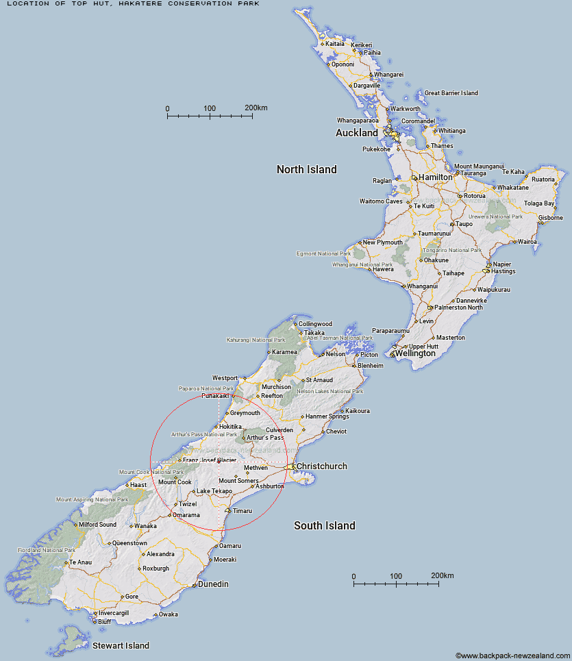
Topo Map showing location of Top Hut
This information is sourced from DoC, LINZ and Openstreetmap. Some of the hut photos are mine and the rest are from DoC. I will be adding an upload feature soon so people can photos of .Top Hut.
Basic info: basic 10-bunk hut in the Mid and South Canterbury area.
Latitude: -43.4207638179
Longitude: 171.028852625
Location: Hakatere Conservation Park
Area: Canterbury
Type of Hut: Basic/bivvies
Map: BW17 Topo Map | Road Map
Does this hut still exist? Have any more information? Contact
Basic info: basic 10-bunk hut in the Mid and South Canterbury area.
Latitude: -43.4207638179
Longitude: 171.028852625
Location: Hakatere Conservation Park
Area: Canterbury
Type of Hut: Basic/bivvies
Map: BW17 Topo Map | Road Map
Does this hut still exist? Have any more information? Contact
Scroll down to see a topographical map and road map showing the location of Top Hut
[ A ] [ B ] [ C ] [ D ] [ E ] [ F ] [ G ] [ H ] [ I ] [ J ] [ K ] [ L ] [ M ] [ N ] [ O ] [ P ] [ Q ] [ R ] [ S ] [ T ] [ U ] [ V ] [ W ] [ Y ] [ Z ]
Closest 20 Huts to Top Hut
These are as the crow fliesHighland Home 3.6km Cameron Hut 6.03km Potts Hut 9.11km Hermitage Hut 9.98km Lawrence Hut 11.62km Lawrence Bivouac 11.88km Downs Hut 12.47km Boundary Creek Hut 12.57km Charlies Hut 12.7km Thompsons Hut 13.27km Banfield Hut 13.78km Erewhon Station Hut 14.85km Washbourne Hut 16.11km Reischek Hut 16.53km Lyell Hut 16.61km Jellicoe Hut 17.03km Lauper Bivouac 17.69km Evans Hut 17.91km Watchdog Hut 19.47km Double Hut 20.49km McCoy Hut 21km Black Mountain Hut 21.37km Manuka Hut 22.25km Dog Kennel Bivouac 25.3km Growler Hut 25.47km Curtis Memorial Hut 25.79km Neave Hut 26.97km Mistake Flats Hut 27.24km Mathias Hut 27.27km Comyns Hut 27.33km Smyth Hut 27.69km Centennial Cabin 27.71km A Frame Hut 27.91km Saint Winifreds Hut 27.93km Moraine Hut 28.31km West Mathias Bivouac 28.69km Murphys Bivvy 28.86km Wilkinson Hut 29.53km Crooked Spur Hut 29.7km Three Creeks Hut 30.5km