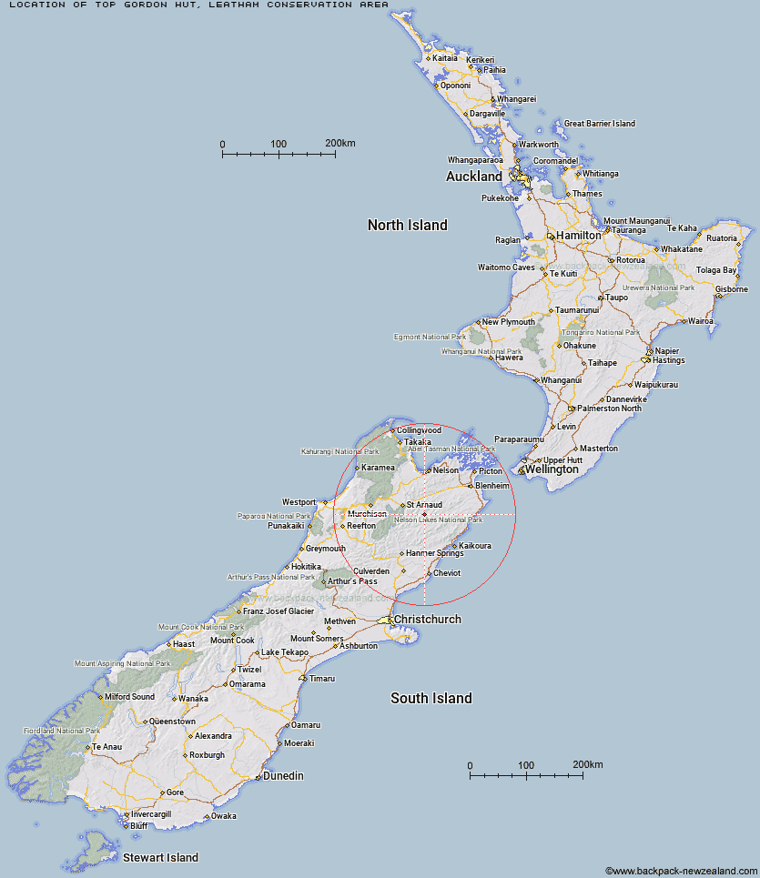
Topo Map showing location of Top Gordon Hut
This information is sourced from DoC, LINZ and Openstreetmap. Some of the hut photos are mine and the rest are from DoC. I will be adding an upload feature soon so people can photos of .Top Gordon Hut.
Basic info: standard 6-bunk hut in the South Marlborough area.
Latitude: -41.9317381833
Longitude: 173.195262761
Location: Leatham Conservation Area
Area: Marlborough
Type of Hut: Standard
Tracks: Leatham Molesworth Route
Map: BS26 Topo Map | Road Map
Does this hut still exist? Have any more information? Contact
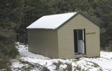
Image: DoC
Scroll down to see a topographical map and road map showing the location of Top Gordon Hut
[ A ] [ B ] [ C ] [ D ] [ E ] [ F ] [ G ] [ H ] [ I ] [ J ] [ K ] [ L ] [ M ] [ N ] [ O ] [ P ] [ Q ] [ R ] [ S ] [ T ] [ U ] [ V ] [ W ] [ Y ] [ Z ]
Closest 20 Huts to Top Gordon Hut
These are as the crow fliesBottom Gordons Hut 4.66km Barbers Hut 7.89km Burnt Yards Hut 9.39km Team Hut 10.15km Top Leatham Hut 10.43km Munroe Hut 10.73km Junction Hut 11.4km Siberia Hut 11.54km Bottom Misery Hut 12.26km Greigs Hut 12.94km Blue Mountain Hut 13.13km Branch Bivouac 13.55km Caves Hut 13.94km Saxton Hut 14.21km Carters Yards Hut 15.15km Lost Stream Bivouac 15.92km Boulder Forks Hut 16.5km Mid Silverstream Hut 17.01km Top Misery Hut 17.46km Lees Creek Hut 18.28km Severn Hut 19.51km Bull Paddock Creek Hut 19.83km Silverstream Bivouac 19.9km Top Whare 21.64km Acheron Hut 21.76km Gosling Hut 21.85km Hidden Hut 22.92km Turkeys Nest Bivouac 23.05km Red Gate Hut 25.23km Connors Creek Hut 26.91km Old Middlehurst Hut 27.41km Red Hills Hut 27.97km Lake McRae Hut 30.08km Lakehead Hut 31.51km Coldwater Hut 32.03km Beebys Hut 32.2km Bushline Hut 32.56km Sedgemere Sleepout 33.29km Relax Shelter 33.72km Bushedge Shelter 33.73km