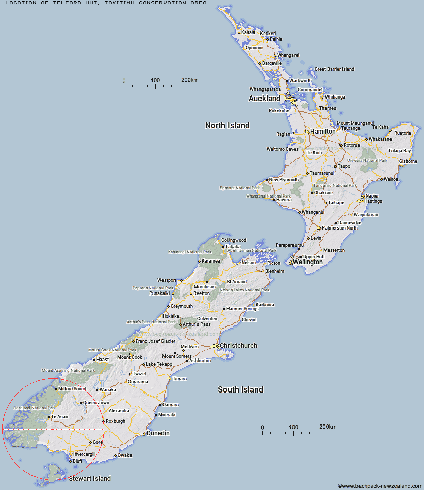
Topo Map showing location of Telford Hut
This information is sourced from DoC, LINZ and Openstreetmap. Some of the hut photos are mine and the rest are from DoC. I will be adding an upload feature soon so people can photos of .Telford Hut.
Basic info: basic two-bunk hut in the Southland area.
Latitude: -45.752277849
Longitude: 167.845982909
Location: Takitimu Conservation Area
Area: Southland
Type of Hut: Basic/bivvies
Map: CE08 Topo Map | Road Map
Does this hut still exist? Have any more information? Contact
Basic info: basic two-bunk hut in the Southland area.
Latitude: -45.752277849
Longitude: 167.845982909
Location: Takitimu Conservation Area
Area: Southland
Type of Hut: Basic/bivvies
Map: CE08 Topo Map | Road Map
Does this hut still exist? Have any more information? Contact
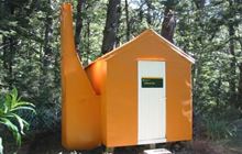
Image: DoC
Scroll down to see a topographical map and road map showing the location of Telford Hut
[ A ] [ B ] [ C ] [ D ] [ E ] [ F ] [ G ] [ H ] [ I ] [ J ] [ K ] [ L ] [ M ] [ N ] [ O ] [ P ] [ Q ] [ R ] [ S ] [ T ] [ U ] [ V ] [ W ] [ Y ] [ Z ]
Closest 20 Huts to Telford Hut
These are as the crow fliesRedcliff Hut 3.79km Upper Wairaki Hut 3.88km Spence Hut 5.79km Lower Wairaki Hut 7.95km Whare Creek Hut 9.49km Rock Hut 9.96km Aparima Forks Hut 11.12km Barcoo Hut 11.85km Aparima Huts 12.91km Cheviot Downs Hut 14.16km Upper Princhester Hut 15.39km Becketts Hut 16.28km Lower Princhester Hut 19.45km Back Valley Hut 26.59km North Borland Hut 28.9km Hope Arm Hut 29.77km Rodger Inlet Huts 33.34km Shallow Bay Hut 34.03km Green Lake Hut 34.79km Moturau Hut 35.21km Borland Bivouac 36.85km Oreti Hut 37.17km Lower Windley Hut 38.55km Monowai Hut 39.57km Clark Hut - A Frame 40.16km Eel Creek Hut 40.22km Brod Bay Shelter and Campsite 40.89km Historic Clark Hut 41.06km Percy Shelter 44.46km Luxmore Hut 44.46km Forest Burn Shelter 45.64km Cromel Base Hut 46.12km Upper Windley Hut 46.77km Islands Hut 46.78km Iris Burn Hut 47.21km Hanging Valley Shelter 47.64km Mt Bee Bunkrooms 48.09km Kiwi Burn Hut 48.11km Caroline Hut 48.39km Lincoln Hut 48.64km