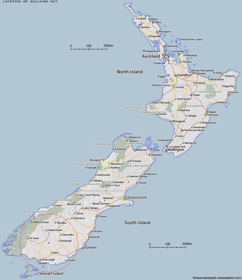
Topo Map showing location of Sullivan Hut
This information is sourced from DoC, LINZ and Openstreetmap. Some of the hut photos are mine and the rest are from DoC. I will be adding an upload feature soon so people can photos of .Sullivan Hut.
Latitude: -45.6408067829
Longitude: 168.788278908
Location:
Type of Hut:
Map: Topo Map | Road Map
Does this hut still exist? Have any more information? Contact
Latitude: -45.6408067829
Longitude: 168.788278908
Location:
Type of Hut:
Map: Topo Map | Road Map
Does this hut still exist? Have any more information? Contact
Scroll down to see a topographical map and road map showing the location of Sullivan Hut
[ A ] [ B ] [ C ] [ D ] [ E ] [ F ] [ G ] [ H ] [ I ] [ J ] [ K ] [ L ] [ M ] [ N ] [ O ] [ P ] [ Q ] [ R ] [ S ] [ T ] [ U ] [ V ] [ W ] [ Y ] [ Z ]
Closest 20 Huts to Sullivan Hut
These are as the crow fliesHyde Home Hut 2.4km Jim Baird Hut 2.46km Dome Hut 9.85km Flaxy Hut 11.04km Junction Hut 12.35km Mud Hut 17.81km Titan Huts 17.94km Black Hut 18.73km Slate Hut 19.2km Stronach Hut 19.42km Garston Ski Hut 21.01km Blue Lake Huts 21.38km Leithen Hut 24.56km Bush Huts 26.79km Beaumont Hut 28.65km Christies Hut 29.25km Mansion Hut 32.39km Junction Hut 34.03km Mt Bee Bunkrooms 34.82km Cromel Base Hut 35.66km McCrimmons Hut 35.9km Andrew Rees Hut 36.32km Potters Huts 36.54km Diggers Hut 38.06km Mitchells Hut 38.07km Cromel Branch Hut 38.19km Shepherd Creek Hut 38.24km Baileys Hut 38.53km Cowshed Hut 38.78km Irthing Hut 39.25km Ross Hut 41.5km Upper Cromel Hut 41.94km Dog Box Bivouac 43.12km Islands Hut 43.26km Boundary Hut 44.38km Nicholsons Hut 44.57km Siberia Hut 45.69km Billy Hut 47.39km Upper Windley Hut 47.87km Lower Windley Hut 48.45km