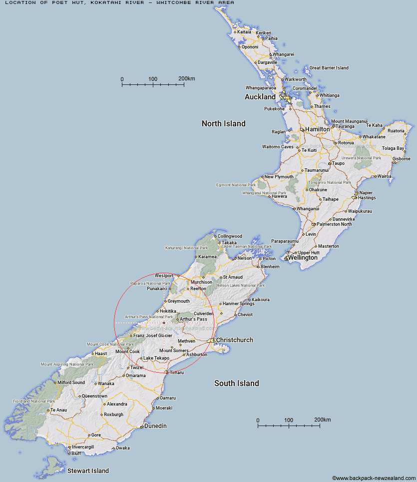
Topo Map showing location of Poet Hut
This information is sourced from DoC, LINZ and Openstreetmap. Some of the hut photos are mine and the rest are from DoC. I will be adding an upload feature soon so people can photos of .Poet Hut.
Basic info: standard four-bunk hut in the Hokitika area.
Latitude: -43.0359849233
Longitude: 171.152375925
Location: Kokatahi River - Whitcombe River area
Area: West Coast
Type of Hut: Standard
Tracks: Toaroha, Hokitika, Lower Whitcombe Track
Map: BV19 Topo Map | Road Map
Does this hut still exist? Have any more information? Contact
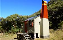
Image: DoC
Scroll down to see a topographical map and road map showing the location of Poet Hut
[ A ] [ B ] [ C ] [ D ] [ E ] [ F ] [ G ] [ H ] [ I ] [ J ] [ K ] [ L ] [ M ] [ N ] [ O ] [ P ] [ Q ] [ R ] [ S ] [ T ] [ U ] [ V ] [ W ] [ Y ] [ Z ]
Closest 20 Huts to Poet Hut
These are as the crow fliesToaroha Saddle Bivouac 1.67km Bluff Hut 2.39km Top Toaroha Hut 2.52km Sir Robert Hut 2.53km Frisco Hut 3.4km Mungo Hut 3.81km Crystal Bivouac 4.4km Mullins Hut 4.96km Yeats Ridge Hut 5.75km Serpentine Hut 6.44km Top Kokatahi Hut 6.59km Frew Saddle Bivouac 6.71km Adventure Bivouac 7.22km Canyon Creek Bivouac 7.99km Cedar Flat Hut 8.15km Gerhardt Spur Bivouac 8.36km Frew Hut 8.98km Unknown Stream Hut 10.4km Crawford Junction Hut 10.73km Pinnacle Bivouac 11.11km Rapid Creek Hut 11.81km Boo Boo Hut 12.55km Urquhart's Hut 13.39km Moa Stream Hut 13.59km Price Flat Hut 14.37km Price Flat Hut 14.38km Top Crawford Hut 15.2km Weka Burnet Bivouac 15.21km West Mathias Bivouac 15.39km Moa Hut 15.98km Moraine Hut 16.02km Centennial Cabin 16.34km Mathias Hut 16.89km Park Morpeth Hut 16.98km Mid Styx Hut 17.34km Mikonui Spur Bivouac 17.54km Browning Range Bivouac 17.62km Explorer Hut 18.06km Price Basin Hut 18.61km Wilkinson Hut 18.83km