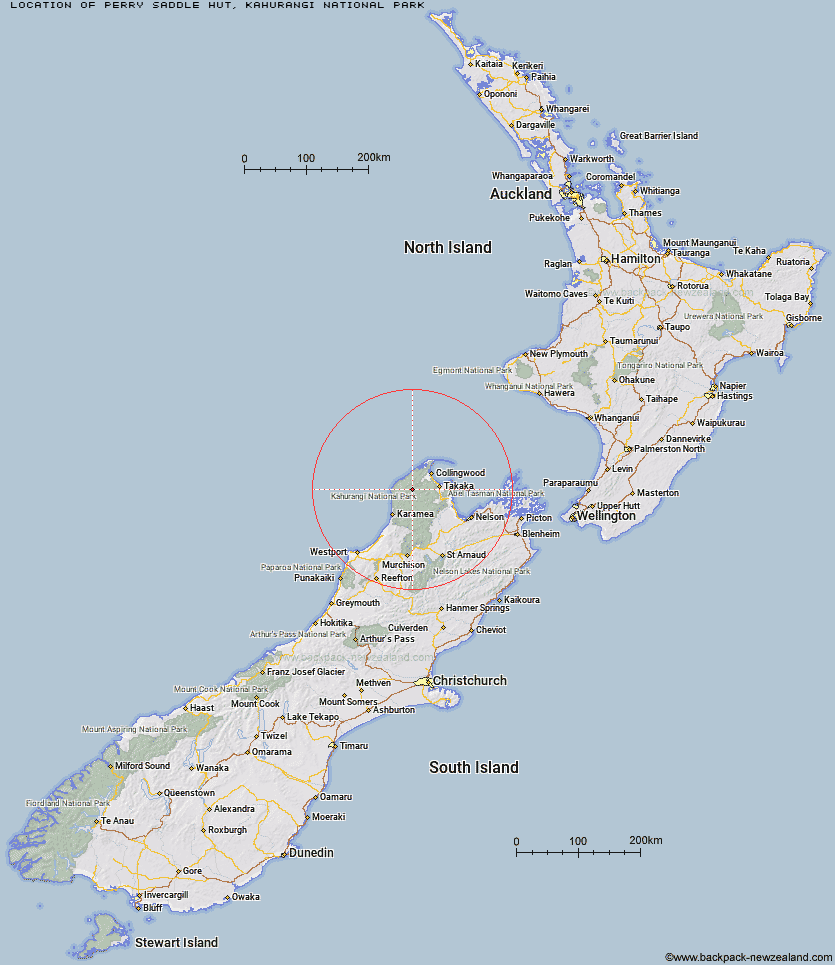
Topo Map showing location of Perry Saddle Hut
This information is sourced from DoC, LINZ and Openstreetmap. Some of the hut photos are mine and the rest are from DoC. I will be adding an upload feature soon so people can photos of .Perry Saddle Hut.
Basic info: 28-bunk hut located on the Heaphy Track in the Golden Bay area.
Latitude: -40.9011510032
Longitude: 172.402904281
Location: Kahurangi National Park
Area: Nelson/Tasman
Type of Hut: Great Walk
Tracks: Heaphy Track
Map: BP23 Topo Map | Road Map
Does this hut still exist? Have any more information? Contact
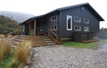
Image: DoC
Scroll down to see a topographical map and road map showing the location of Perry Saddle Hut
[ A ] [ B ] [ C ] [ D ] [ E ] [ F ] [ G ] [ H ] [ I ] [ J ] [ K ] [ L ] [ M ] [ N ] [ O ] [ P ] [ Q ] [ R ] [ S ] [ T ] [ U ] [ V ] [ W ] [ Y ] [ Z ]
Closest 20 Huts to Perry Saddle Hut
These are as the crow fliesGouland Downs Hut 4.33km Brown Hut 6.77km Saxon Hut 8.13km Adelaide Tarn Hut 12.68km Boulder Lake Hut 14.79km Ministry of Works Historic Hut 15.03km James Mackay Hut 15.72km Lonely Lake Hut 15.87km Anatoki Forks Hut 17.77km Fenella Hut 19.44km Cobb Hut 20.03km Soper Shelter 20.05km Tent Camp 21.5km Lewis Hut 21.85km Chaffey Hut 25.73km Heaphy Hut 26.32km Waingaro Forks Hut 27.87km Katipo Creek Shelter 29.51km Sylvester Hut 30.49km Trilobite Hut 30.8km Myttons Hut 31.9km Tin Hut Shelter 32.53km Riordans Hut 32.74km Roaring Lion Hut 33.1km Kohaihai Shelter 34.17km Sunshine Flat Shelter 34.6km Balloon Hut 35.03km Asbestos Cottage 35.13km Adams Flat Hut 36.61km Growler Rock Shelter 37.33km Dry Rock Shelter 37.57km Splugeons Rock Shelter 37.97km Karamea Bend Hut 38.01km Upper Gridiron Hut and Rock Shelters 38.79km Greys Hut 39.06km Flora Hut 41.62km Mt Arthur Hut 42.14km Wainui Hut 43.51km Crow Hut 43.97km Flanagans Hut 44.13km