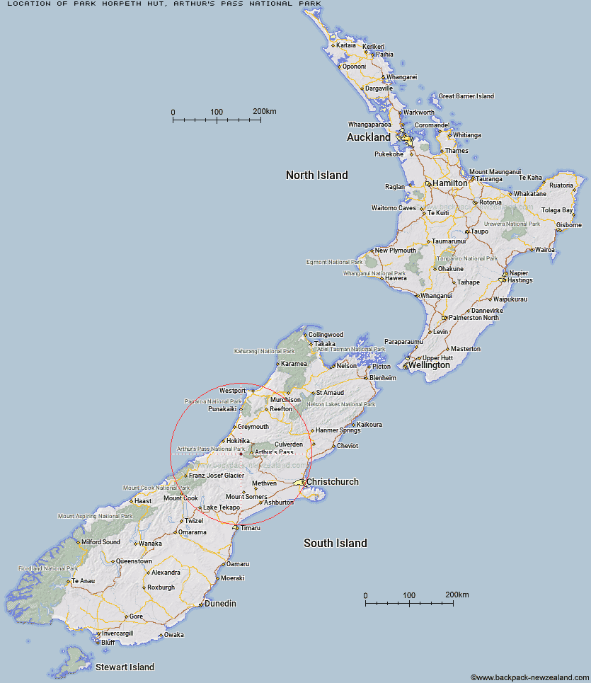
Topo Map showing location of Park Morpeth Hut
This information is sourced from DoC, LINZ and Openstreetmap. Some of the hut photos are mine and the rest are from DoC. I will be adding an upload feature soon so people can photos of .Park Morpeth Hut.
Basic info: standard six-bunk hut in the North Canterbury and Arthur's Pass area.
Latitude: -42.9718024603
Longitude: 171.341905262
Location: Arthur's Pass National Park
Area: Canterbury
Type of Hut: Serviced Alpine
Tracks: Three Passes Route
Map: BV20 Topo Map | Road Map
Does this hut still exist? Have any more information? Contact
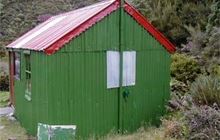
Image: DoC
Scroll down to see a topographical map and road map showing the location of Park Morpeth Hut
[ A ] [ B ] [ C ] [ D ] [ E ] [ F ] [ G ] [ H ] [ I ] [ J ] [ K ] [ L ] [ M ] [ N ] [ O ] [ P ] [ Q ] [ R ] [ S ] [ T ] [ U ] [ V ] [ W ] [ Y ] [ Z ]
Closest 20 Huts to Park Morpeth Hut
These are as the crow fliesBarker Hut 4.92km Harman Hut 6.04km Top Crawford Hut 6.54km Urquhart's Hut 7.21km Campbell Bivouac 8.24km Carrington Hut 8.77km Crawford Junction Hut 8.84km Weka Burnet Bivouac 9.04km Browning Range Bivouac 9.18km Grassy Flat Hut 9.73km Julia Hut 10.64km Old Julia Hut 10.66km Mudflats Hut 11.02km Avoca Hut 11.55km Mid Styx Hut 11.58km Newton Range Bivouac 11.77km Unknown Stream Hut 11.84km Top Kokatahi Hut 12.51km Boo Boo Hut 12.64km Mungo Hut 13.22km Lower Arahura Hut 13.29km Waimakariri Falls Hut 13.31km Pinnacle Bivouac 13.83km Anti Crow Hut 14.13km Adventure Bivouac 14.35km Crow Hut 14.6km Newton Creek Hut 14.8km Back Basin Hide 14.82km Lower Olderog Bivouac 15.15km Moa Hut 15.31km Toaroha Saddle Bivouac 15.53km Crystal Bivouac 15.63km Yeats Ridge Hut 15.77km Mid Taipo Hut 15.86km Top Toaroha Hut 15.97km Cedar Flat Hut 16.12km Mt Brown Hut 16.24km Top Olderog Bivouac 16.64km Dunns Creek Hut 16.8km Poet Hut 16.98km