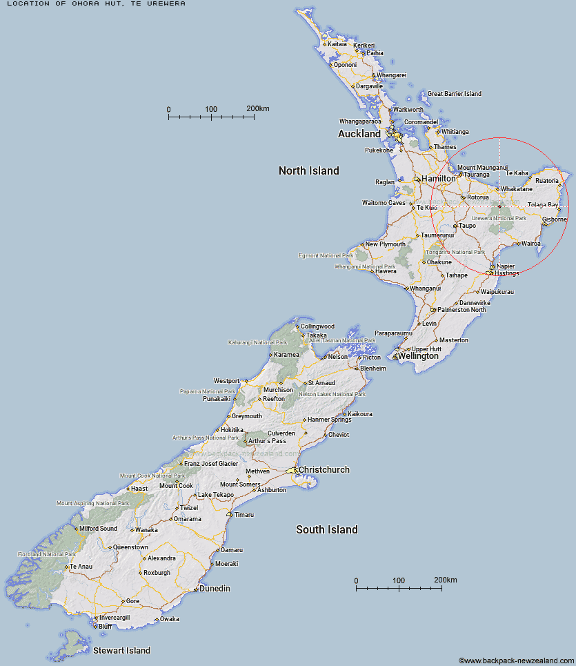
Topo Map showing location of Ohora Hut
This information is sourced from DoC, LINZ and Openstreetmap. Some of the hut photos are mine and the rest are from DoC. I will be adding an upload feature soon so people can photos of .Ohora Hut.
Basic info: standard 19-bunk hut in the Te Urewera area.
Latitude: -38.3141797483
Longitude: 177.017962551
Location: Te Urewera
Area: East Coast
Type of Hut: Standard
Tracks: Waimana Valley tracks
Map: BF40 Topo Map | Road Map
Does this hut still exist? Have any more information? Contact
Basic info: standard 19-bunk hut in the Te Urewera area.
Latitude: -38.3141797483
Longitude: 177.017962551
Location: Te Urewera
Area: East Coast
Type of Hut: Standard
Tracks: Waimana Valley tracks
Map: BF40 Topo Map | Road Map
Does this hut still exist? Have any more information? Contact
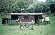
Image: DoC
Scroll down to see a topographical map and road map showing the location of Ohora Hut
[ A ] [ B ] [ C ] [ D ] [ E ] [ F ] [ G ] [ H ] [ I ] [ J ] [ K ] [ L ] [ M ] [ N ] [ O ] [ P ] [ Q ] [ R ] [ S ] [ T ] [ U ] [ V ] [ W ] [ Y ] [ Z ]
Closest 20 Huts to Ohora Hut
These are as the crow fliesOnepu Hut 4.2km Apiti Hut 5.9km Wharekahika Hut 7.36km Saddle (Mangaawai) Hut 8.1km Waikare Junction Hut 8.65km Twain (Waipotiki) Hut 9.37km Casino Hut 9.53km Ohane Hut 9.57km Waihua Hut 12.03km Mangamako Hut 12.47km Duckville Hut 13.28km Hanamahihi Hut 13.85km Manaohou Right Branch Hut 14.04km Te Pourewa Hut 14.24km Otapukawa Hut 14.36km Koaunui Hut 14.45km Te Panaa Hut 17.71km Takurua Hut 18.51km Otane Hut 19.67km Horomanga Base Camp 19.77km Otanetea Hut 19.86km Te Pua Hut 19.88km Ngahiramai Hut 20.12km Tawhiwhi Hut 22.17km Taurawharona Hut 23.23km Tataweka Hut 23.68km Nikau Flat Hut 24.2km Tawa Hut 25.14km Koranga Forks Hut 25.26km Makomako Hut 26.51km Mangatoatoa Hut 27.09km Kotepato Hut 27.1km Makakoere Hut 27.15km Waiawa Hut 28.02km Te Rangaakapua Hut 28.16km Kahunui Hut 29.12km Mangapouri Hut 29.56km Brills Bivouac 30.62km Okui Hut 30.92km Kanohirua Hut 32.05km