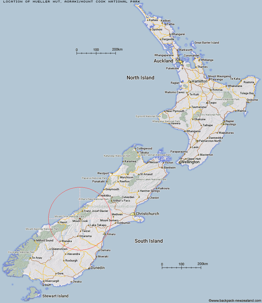
Topo Map showing location of Mueller Hut
This information is sourced from DoC, LINZ and Openstreetmap. Some of the hut photos are mine and the rest are from DoC. I will be adding an upload feature soon so people can photos of .Mueller Hut.
Basic info: This is an alpine serviced 28-bunk hut in the Aoraki/Mount Cook area.
Latitude: -43.72091834
Longitude: 170.065166961
Location: Aoraki/Mount Cook National Park
Area: Canterbury
Type of Hut: Serviced Alpine
Tracks: Mueller Hut Route
Map: BX15 Topo Map | Road Map
Does this hut still exist? Have any more information? Contact
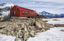
Image: DoC
Scroll down to see a topographical map and road map showing the location of Mueller Hut
[ A ] [ B ] [ C ] [ D ] [ E ] [ F ] [ G ] [ H ] [ I ] [ J ] [ K ] [ L ] [ M ] [ N ] [ O ] [ P ] [ Q ] [ R ] [ S ] [ T ] [ U ] [ V ] [ W ] [ Y ] [ Z ]
Closest 20 Huts to Mueller Hut
These are as the crow fliesStocking Stream Shelter 3.59km Sefton Bivvy 3.77km Barron Saddle Hut 6.7km Harpers Rock Bivouac 7.13km Copland Shelter 7.8km Douglas Rock Hut 8.41km Reardon Hut 10.55km Horace Walker Hut 12.04km Christmas Flat Hut 12.59km Caroline Hut 12.72km Welcome Flat Campsite 13.86km Welcome Flat Hut 13.88km Waterfall Hut 13.92km Ball Hut 14.71km Empress Hut 14.76km Green Point Hut 15.99km Lame Duck Hut 16.01km Littles Hut 16.43km Richardson Rock Bivouac 16.56km Plateau Hut 18.01km Jollie Hut 18.17km Erceg Hut 18.45km Haast Hut 18.65km Architect Creek Hut 18.86km Kennedy Hut 19.48km Cassel Flat Hut 20.38km Liebig Hut 22.24km Onslow Hut (Steffan Memorial Hut) 23.06km Pioneer Hut 23.11km Chancellor Hut 23.68km Dodger Hut 24.54km Whale Stream Hut 25.07km Grough Hut 25.47km Memorial Hut 26.1km Birdcage Hut 26.42km Tin Hut 26.81km Waterfall Hut 27.21km Centennial Hut 27.28km Ryders Hut 28.16km Station Hut 28.86km