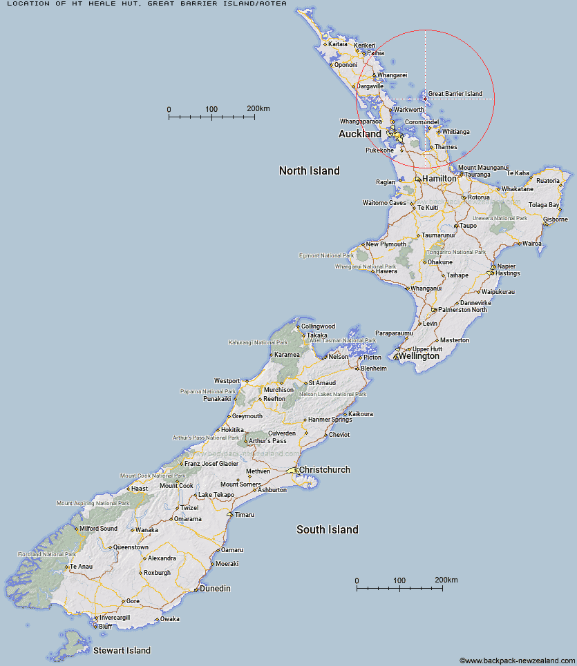
Topo Map showing location of Mt Heale Hut
This information is sourced from DoC, LINZ and Openstreetmap. Some of the hut photos are mine and the rest are from DoC. I will be adding an upload feature soon so people can photos of .Mt Heale Hut.
Basic info: serviced 20-bunk hut on Great Barrier Island. The hut must be booked in advance online.
Latitude: -36.1934116502
Longitude: 175.413018932
Location: Great Barrier Island/Aotea
Area: Auckland
Type of Hut: Serviced
Tracks: Aotea Track|Windy Canyon and Palmer's Track to Mt Hobson (Hirakimata)
Map: AY34 Topo Map | Road Map
Does this hut still exist? Have any more information? Contact
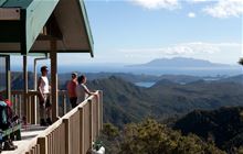
Image: DoC
Scroll down to see a topographical map and road map showing the location of Mt Heale Hut
[ A ] [ B ] [ C ] [ D ] [ E ] [ F ] [ G ] [ H ] [ I ] [ J ] [ K ] [ L ] [ M ] [ N ] [ O ] [ P ] [ Q ] [ R ] [ S ] [ T ] [ U ] [ V ] [ W ] [ Y ] [ Z ]
Closest 20 Huts to Mt Heale Hut
These are as the crow fliesKaiaraara Hut 3.35km Peach Cove Hut 84.86km Crosbies Hut 96.29km Pinnacles Hut 98.08km Piggotts Hut 99.68km Ongaruanuku Hut 113.71km Tangihua Lodge 120.16km Tangihua Hut 123.19km Daly's Clearing Hut 146.91km Cape Brett Hut 149.78km Mangakino Shelter 149.94km Waitawheta Hut 152.28km Wairoa Shelter 155.01km Te Rereatukahia Hut 159.25km Motutapere Hut 163.34km Kauritatahi Hut 168.42km Ngamuwahine Shelter 181.68km Mangamuka Hut 182.42km Puketi Forest Hut 182.47km Hurunui Hut 186.3km Motukawanui Hut 187.63km Frampton's Hut 190.57km Lane Cove Hut 200.93km Pahautea Hut 202.17km Hamilton Tomo Group Hut 231.13km Wildlife Hut 242.8km Wairua Hut 244.49km Leitchs Hut 255.13km Waihua Hut 265.99km Twain (Waipotiki) Hut 266km Bog Inn Hut 266.41km Saddle (Mangaawai) Hut 268km Mangamako Hut 268.87km Apiti Hut 269.75km Wharekahika Hut 269.95km Casino Hut 270.42km Duckville Hut 273.86km Ohora Hut 275.28km Horomanga Base Camp 276.44km Hastings Hut 276.86km