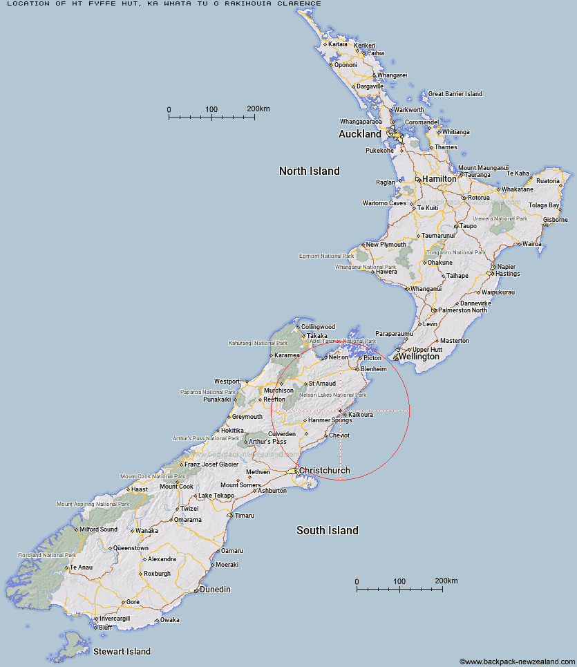
Topo Map showing location of Mt Fyffe Hut
This information is sourced from DoC, LINZ and Openstreetmap. Some of the hut photos are mine and the rest are from DoC. I will be adding an upload feature soon so people can photos of .Mt Fyffe Hut.
Basic info: standard 8-bunk hut in the South Marlborough area.
Latitude: -42.3240266527
Longitude: 173.593432345
Location: Ka Whata Tu o Rakihouia Clarence
Area: Marlborough
Type of Hut: Standard
Tracks: Mt Fyffe and the Seaward Kaikoura Range
Map: BT27 Topo Map | Road Map
Does this hut still exist? Have any more information? Contact
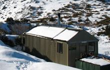
Image: DoC
Scroll down to see a topographical map and road map showing the location of Mt Fyffe Hut
[ A ] [ B ] [ C ] [ D ] [ E ] [ F ] [ G ] [ H ] [ I ] [ J ] [ K ] [ L ] [ M ] [ N ] [ O ] [ P ] [ Q ] [ R ] [ S ] [ T ] [ U ] [ V ] [ W ] [ Y ] [ Z ]
Closest 20 Huts to Mt Fyffe Hut
These are as the crow fliesKowhai Hut 2.85km Hapuku Hut 7.46km Limestone Hut 10.92km Barratts Hut 10.94km Barratts Bivouac 11.04km Dubious Bivouac 12.18km Tent Poles Hut 12.81km Warden Hut 13.71km Black Spur Historic Hut 14.73km Kahutara Bivouac 15.36km Fidgit Bivouac 16.65km Goose Flat Hut 19.54km Seymour Hut 19.64km Alfred Hut 20.12km Stone Jug Hut 23.49km Haycocks Bivouac 24.14km Jam Hut 27.32km Ravine Hut 27.49km Lake McRae Hut 27.58km Palmer Hut 27.63km Palmer Bivouac 27.73km Hornby Bivvy 31.23km Snowgrass Hut 32.57km Cloudy Hut 35.52km Half Moon Hut 37.7km Dee Hut 38.31km Gibson Hut 39.57km Old Middlehurst Hut 40.06km Cabbage Tree Hut 42.36km Mead Hut 42.93km Guide Hut 43.37km Carters Yards Hut 43.59km Munroe Hut 44.12km Acheron Hut 45.33km Junction Hut 45.47km Burnt Yards Hut 46.74km Saxton Hut 47.04km Cam Hut 47.06km Team Hut 48.6km Yarra Hut 49.23km