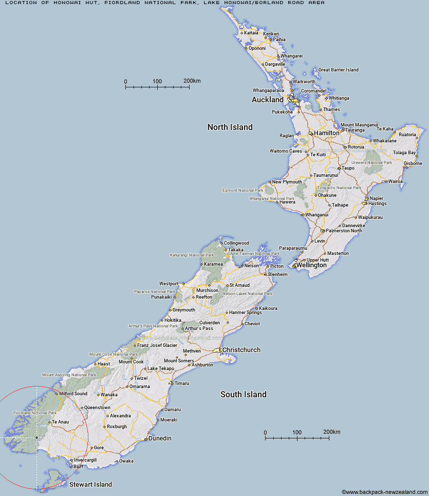
Topo Map showing location of Monowai Hut
This information is sourced from DoC, LINZ and Openstreetmap. Some of the hut photos are mine and the rest are from DoC. I will be adding an upload feature soon so people can photos of .Monowai Hut.
Basic info: standard 12-bunk hut in southern Fiordland.
Latitude: -45.8343144455
Longitude: 167.349332163
Location: Fiordland National Park, Lake Monowai/Borland Road area
Area: Fiordland
Type of Hut: Standard
Map: CE07 Topo Map | Road Map
Does this hut still exist? Have any more information? Contact
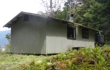
Image: DoC
Scroll down to see a topographical map and road map showing the location of Monowai Hut
[ A ] [ B ] [ C ] [ D ] [ E ] [ F ] [ G ] [ H ] [ I ] [ J ] [ K ] [ L ] [ M ] [ N ] [ O ] [ P ] [ Q ] [ R ] [ S ] [ T ] [ U ] [ V ] [ W ] [ Y ] [ Z ]
Closest 20 Huts to Monowai Hut
These are as the crow fliesMonowai Hut 0km Clark Hut - A Frame 4.87km Eel Creek Hut 5.41km Historic Clark Hut 6.03km Green Lake Hut 6.7km Rodger Inlet Huts 7.71km Borland Bivouac 10.63km Caroline Hut 12.95km Hauroko Burn Hut 15.8km Halfway Hut 18.01km North Borland Hut 19.62km Lake Roe Hut 21.59km Teal Bay Hut 26.17km Percy Shelter 27.33km Loch Maree Hut 27.58km Kintail Hut 30.42km Hope Arm Hut 31km Back Valley Hut 31.64km Upper Spey Hut 31.73km Lake Poteriteri Hut 34.28km Supper Cove Hut 34.66km West Arm Hut 34.98km Okaka Lodge 36.24km Redcliff Hut 39.14km Barcoo Hut 39.47km Telford Hut 39.57km Cheviot Downs Hut 40.65km Whare Creek Hut 41.36km Rock Hut 41.65km Shallow Bay Hut 43.07km Port Craig Lodge 43.11km Port Craig School Hut 43.18km Upper Wairaki Hut 43.3km Spence Hut 43.5km Freeman Burn Hut 43.87km Moturau Hut 44.15km Percy Burn Hut 45.39km Slaughterburn Hut 45.41km Lower Wairaki Hut 46.24km Wairaurahiri Hut 47.76km