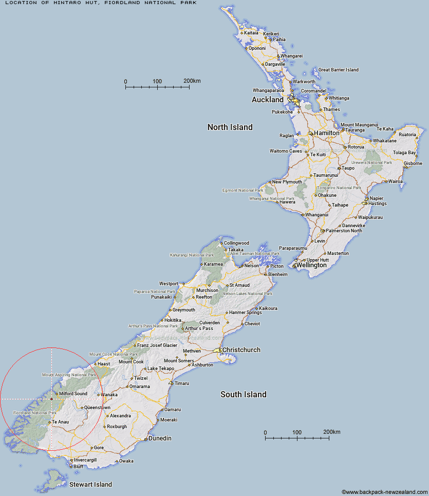
Topo Map showing location of Mintaro Hut
This information is sourced from DoC, LINZ and Openstreetmap. Some of the hut photos are mine and the rest are from DoC. I will be adding an upload feature soon so people can photos of .Mintaro Hut.
Basic info: 40-bunk, Great Walk hut on the Milford Track, Fiordland. Bookings required in the Great Walks season.
Latitude: -44.8097341693
Longitude: 167.781538234
Location: Fiordland National Park
Area: Fiordland
Type of Hut: Great Walk
Tracks: Milford Track
Map: CB08 Topo Map | Road Map
Does this hut still exist? Have any more information? Contact
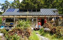
Image: DoC
Scroll down to see a topographical map and road map showing the location of Mintaro Hut
[ A ] [ B ] [ C ] [ D ] [ E ] [ F ] [ G ] [ H ] [ I ] [ J ] [ K ] [ L ] [ M ] [ N ] [ O ] [ P ] [ Q ] [ R ] [ S ] [ T ] [ U ] [ V ] [ W ] [ Y ] [ Z ]
Closest 20 Huts to Mintaro Hut
These are as the crow fliesMackinnon Pass Shelter 0.95km Andersons Cascade Shelter 1.86km Quintin Lodge 3.02km Pompolona Lodge 3.46km Bus Stop Shelter 3.84km Prairie Shelter 4.66km Dumpling Hut 4.8km Boatshed Shelter 8.15km Hirere Shelter 8.15km Boatshed Hut 8.15km Giant Gate Shelter 12.73km Clinton Hut 14.63km Worsley Hut 15.33km Sandfly Point Shelter 16.86km Glade House 16.98km Homer Hut 18.07km Gill's Bivvy 21.67km Phil's Bivvy 21.67km Glaisnock Hut 21.99km The Divide Shelter 26.56km Lake Howden Hut 27.92km Turners Bivouac 28.3km Pawnbroker Rock 29.3km McKellar Lodge 29.36km McKellar Hut 29.48km Lake Thomson Hut 30.75km Lake Mackenzie Lodge 31.26km Lake Mackenzie Hut 31.3km Lake Hankinson Hut 31.31km George Sound Hut 33.14km Sunshine Hut 33.3km Hidden Falls Hut 33.48km Routeburn Falls Lodge 34.23km Routeburn Falls Hut 34.28km Upper Caples Hut 34.96km Rats Nest Hut 35.25km Routeburn Flats Hut 35.5km Steele Creek Hut 36.46km Kay Creek Hut 36.69km Kaipo Hut 37.95km