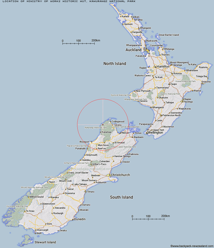
Topo Map showing location of Ministry of Works Historic Hut
This information is sourced from DoC, LINZ and Openstreetmap. Some of the hut photos are mine and the rest are from DoC. I will be adding an upload feature soon so people can photos of .Ministry of Works Historic Hut.
Basic info: basic 6-bunk hut in the Golden Bay area.
Latitude: -40.8429851766
Longitude: 172.241505515
Location: Kahurangi National Park
Area: Nelson/Tasman
Type of Hut: Basic/bivvies
Map: BN22 Topo Map | Road Map
Does this hut still exist? Have any more information? Contact
Basic info: basic 6-bunk hut in the Golden Bay area.
Latitude: -40.8429851766
Longitude: 172.241505515
Location: Kahurangi National Park
Area: Nelson/Tasman
Type of Hut: Basic/bivvies
Map: BN22 Topo Map | Road Map
Does this hut still exist? Have any more information? Contact
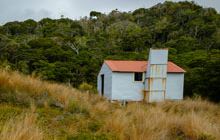
Image: DoC
Scroll down to see a topographical map and road map showing the location of Ministry of Works Historic Hut
[ A ] [ B ] [ C ] [ D ] [ E ] [ F ] [ G ] [ H ] [ I ] [ J ] [ K ] [ L ] [ M ] [ N ] [ O ] [ P ] [ Q ] [ R ] [ S ] [ T ] [ U ] [ V ] [ W ] [ Y ] [ Z ]
Closest 20 Huts to Ministry of Works Historic Hut
These are as the crow fliesMinistry of Works Historic Hut 0km James Mackay Hut 5.22km Saxon Hut 7.39km Gouland Downs Hut 10.79km Lewis Hut 13.35km Perry Saddle Hut 15.03km Brown Hut 17.33km Heaphy Hut 19.39km Katipo Creek Shelter 25.07km Adelaide Tarn Hut 27.69km Boulder Lake Hut 29.06km Lonely Lake Hut 30.79km Kohaihai Shelter 31.79km Anatoki Forks Hut 32.64km Fenella Hut 33.1km Cobb Hut 33.58km Soper Shelter 34.94km Tent Camp 35.06km Sunshine Flat Shelter 36.79km Chaffey Hut 39.35km Adams Flat Hut 39.49km Roaring Lion Hut 42.63km Waingaro Forks Hut 42.75km Greys Hut 44.14km Trilobite Hut 44.41km Sylvester Hut 44.71km Myttons Hut 45.59km Tin Hut Shelter 47.55km Riordans Hut 47.75km Balloon Hut 48.34km Karamea Bend Hut 48.91km Asbestos Cottage 49.45km Splugeons Rock Shelter 50.71km Dry Rock Shelter 51.18km Growler Rock Shelter 51.19km Upper Gridiron Hut and Rock Shelters 52.78km Crow Hut 53.59km Kākāpō Hut 54.68km Venus Hut 55.25km Flora Hut 55.73km