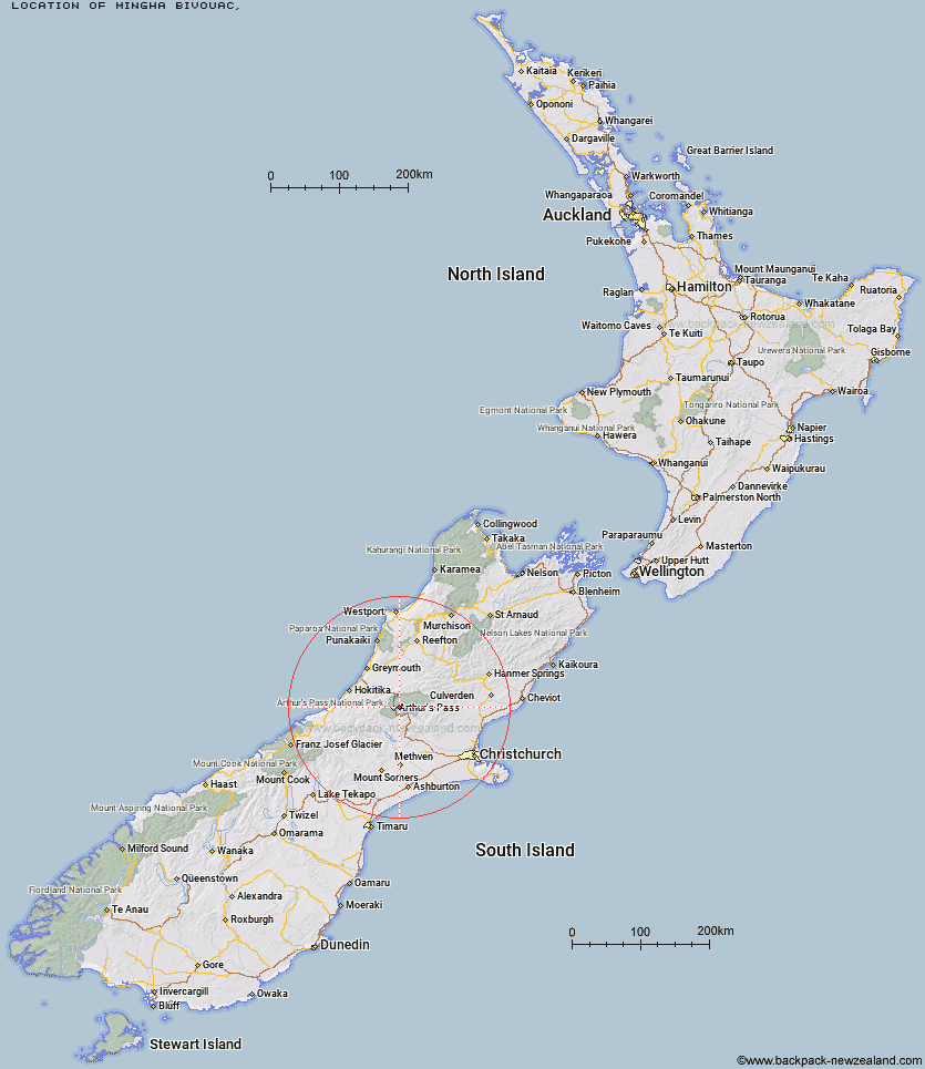
Topo Map showing location of Mingha Bivouac
This information is sourced from DoC, LINZ and Openstreetmap. Some of the hut photos are mine and the rest are from DoC. I will be adding an upload feature soon so people can photos of .Mingha Bivouac.
Latitude: -42.9227794543
Longitude: 171.629960553
Location:
Type of Hut:
Map: Topo Map | Road Map
Does this hut still exist? Have any more information? Contact
Latitude: -42.9227794543
Longitude: 171.629960553
Location:
Type of Hut:
Map: Topo Map | Road Map
Does this hut still exist? Have any more information? Contact
Scroll down to see a topographical map and road map showing the location of Mingha Bivouac
[ A ] [ B ] [ C ] [ D ] [ E ] [ F ] [ G ] [ H ] [ I ] [ J ] [ K ] [ L ] [ M ] [ N ] [ O ] [ P ] [ Q ] [ R ] [ S ] [ T ] [ U ] [ V ] [ W ] [ Y ] [ Z ]
Closest 20 Huts to Mingha Bivouac
These are as the crow fliesMingha Bivouac 0km Goat Pass Hut 2.4km Edwards Hut 2.58km Upper Deception Hut 4.42km Jacks Hut 5.8km Sudden Valley Bivouac 6.77km Greyneys Shelter 7.56km Hawdon Hut 8.47km Klondyke Shelter 9.44km Crow Hut 9.48km Otehake Hut 9.79km Waimakariri Falls Hut 11.6km Hawdon Shelter 11.96km East Hawdon Bivouac 12.17km Bealey Hut 12.82km Anti Crow Hut 12.89km Bealey Spur Hut 13.2km Pfeifer Bivouac 13.6km Hunts Creek Hut 13.87km Worsley Bivouac 14.78km Lagoon Saddle Hut 14.86km Riversdale Hut 14.87km Lagoon Saddle A Frame Hut 14.89km Koropuku Hut 14.98km Carrington Hut 15.35km Andrews Shelter 15.45km Carroll Hut 16.02km Poulter Bivouac 16.58km Poulter Hut 16.78km Old Julia Hut 16.89km Julia Hut 16.96km Mid Taipo Hut 17.22km Trust/Poulter Hut 18.92km Dunns Creek Hut 19.11km Dillon Hut 19.16km Dillons Homestead Hut 19.48km West Harper Hut 19.77km Cass Saddle Hut 20.02km Barker Hut 20.29km Townsend Hut 20.43km