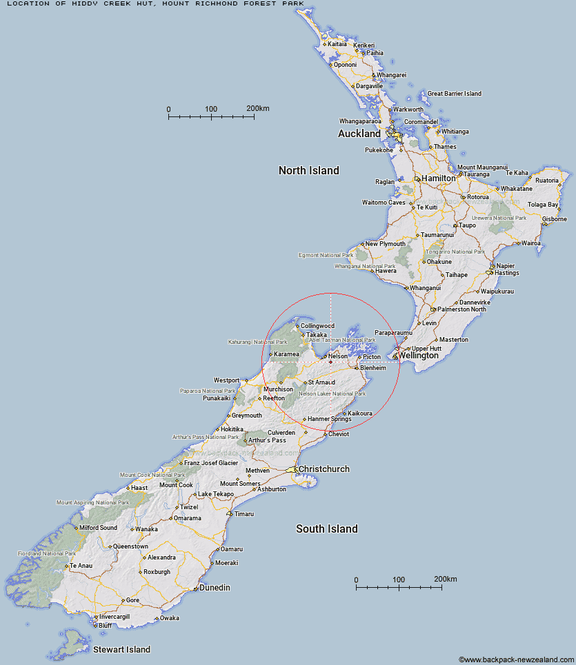
Topo Map showing location of Middy Creek Hut
This information is sourced from DoC, LINZ and Openstreetmap. Some of the hut photos are mine and the rest are from DoC. I will be adding an upload feature soon so people can photos of .Middy Creek Hut.
Basic info: standard 6-bunk hut in the Sounds area.
Latitude: -41.3842496467
Longitude: 173.392660858
Location: Mount Richmond Forest Park
Area: Marlborough
Type of Hut: Standard
Tracks: Pelorus Track
Map: BQ26 Topo Map | Road Map
Does this hut still exist? Have any more information? Contact
Basic info: standard 6-bunk hut in the Sounds area.
Latitude: -41.3842496467
Longitude: 173.392660858
Location: Mount Richmond Forest Park
Area: Marlborough
Type of Hut: Standard
Tracks: Pelorus Track
Map: BQ26 Topo Map | Road Map
Does this hut still exist? Have any more information? Contact
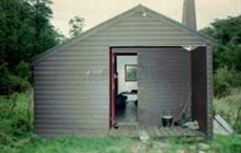
Image: DoC
Scroll down to see a topographical map and road map showing the location of Middy Creek Hut
[ A ] [ B ] [ C ] [ D ] [ E ] [ F ] [ G ] [ H ] [ I ] [ J ] [ K ] [ L ] [ M ] [ N ] [ O ] [ P ] [ Q ] [ R ] [ S ] [ T ] [ U ] [ V ] [ W ] [ Y ] [ Z ]
Closest 20 Huts to Middy Creek Hut
These are as the crow fliesRocks Hut 3.65km Captain Creek Hut 3.72km Roebuck Hut 4.27km Dun Shelter 4.78km Mt Fell Hut 8.37km Third House Shelter 8.67km Richmond Saddle Hut 10km Browning Hut 10.21km Fishtail Hut 10.61km Hacket Hut 12.75km Slaty Hut 14.75km Starveall Hut 15.02km Devils Creek Hut 15.79km Old Man Hut 18.62km Mt Rintoul Hut 20.76km Lake Chalice Hut 21.29km Fosters Hut 21.33km Mt Sunday Bivouac 24.03km Chimney 24.33km Mid Goulter Hut 25.45km Tarn Hut 26.41km Mid Wairoa Hut 30.67km Lower Goulter Hut 31.15km Top Wairoa Hut 36.51km Hunters Hut 40.33km Hidden Hut 40.34km Turkeys Nest Bivouac 40.78km McNaughts Hut 41.96km Ramshead Hut 42.65km Gosling Hut 42.95km Porters Creek Hut 44.5km Dillon Hut 45.45km Beehive Hut 45.67km Lake Alexander Hut 46.37km Boulder Forks Hut 46.56km Omaka Bivouac 47.12km Tinpot Hut 49.24km Caves Hut 49.87km Penk Hut 50.9km Red Hills Hut 51.01km