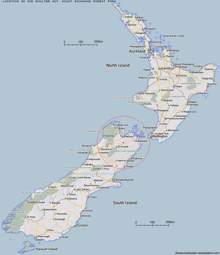
Topo Map showing location of Mid Goulter Hut
This information is sourced from DoC, LINZ and Openstreetmap. Some of the hut photos are mine and the rest are from DoC. I will be adding an upload feature soon so people can photos of .Mid Goulter Hut.
Basic info: standard 8-bunk hut in the South Marlborough area.
Latitude: -41.5805373428
Longitude: 173.235497417
Location: Mount Richmond Forest Park
Area: Marlborough
Type of Hut: Standard
Tracks: Chalice–Goulter Track
Map: BR25 Topo Map | Road Map
Does this hut still exist? Have any more information? Contact
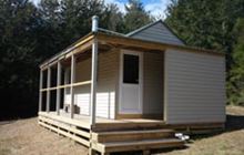
Image: DoC
Scroll down to see a topographical map and road map showing the location of Mid Goulter Hut
[ A ] [ B ] [ C ] [ D ] [ E ] [ F ] [ G ] [ H ] [ I ] [ J ] [ K ] [ L ] [ M ] [ N ] [ O ] [ P ] [ Q ] [ R ] [ S ] [ T ] [ U ] [ V ] [ W ] [ Y ] [ Z ]
Closest 20 Huts to Mid Goulter Hut
These are as the crow fliesLower Goulter Hut 6.1km Tarn Hut 6.45km Old Man Hut 6.88km Mt Rintoul Hut 6.92km Lake Chalice Hut 7.19km Mid Wairoa Hut 9.55km Slaty Hut 11.16km Starveall Hut 13.65km Top Wairoa Hut 13.73km Richmond Saddle Hut 17.09km Hacket Hut 18.33km Hidden Hut 18.4km Browning Hut 18.86km Hunters Hut 19.45km Turkeys Nest Bivouac 19.86km Mt Fell Hut 20.23km Roebuck Hut 21.31km Porters Creek Hut 21.4km Gosling Hut 22.73km Boulder Forks Hut 23.35km Caves Hut 25.4km Middy Creek Hut 25.45km Rocks Hut 25.73km Fishtail Hut 25.89km Red Hills Hut 26.29km Captain Creek Hut 28.35km Silverstream Bivouac 28.65km Dun Shelter 28.7km Third House Shelter 29.34km Beebys Hut 29.62km Greigs Hut 30.46km Mid Silverstream Hut 31.34km Barbers Hut 31.95km Blue Mountain Hut 32.23km Top Whare 33.39km Devils Creek Hut 33.82km Bull Paddock Creek Hut 34.35km Siberia Hut 35.79km Lost Stream Bivouac 36.2km Chimney 37.43km