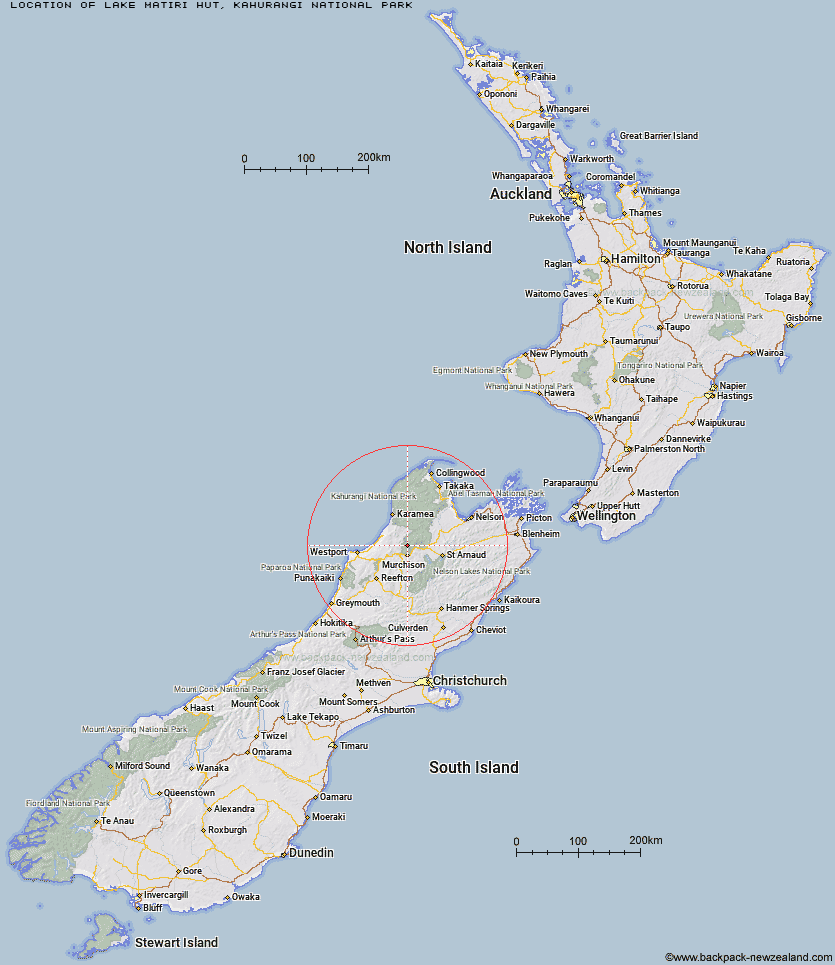
Topo Map showing location of Lake Matiri Hut
This information is sourced from DoC, LINZ and Openstreetmap. Some of the hut photos are mine and the rest are from DoC. I will be adding an upload feature soon so people can photos of .Lake Matiri Hut.
Basic info: standard 8-bunk hut in the Kahurangi National Park.
Latitude: -41.6560213935
Longitude: 172.330227432
Location: Kahurangi National Park
Area: Nelson/Tasman
Type of Hut: Standard
Tracks: Matiri Valley and 1000 Acre Plateau tramping tracks
Map: BR23 Topo Map | Road Map
Does this hut still exist? Have any more information? Contact
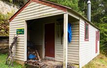
Image: DoC
Scroll down to see a topographical map and road map showing the location of Lake Matiri Hut
[ A ] [ B ] [ C ] [ D ] [ E ] [ F ] [ G ] [ H ] [ I ] [ J ] [ K ] [ L ] [ M ] [ N ] [ O ] [ P ] [ Q ] [ R ] [ S ] [ T ] [ U ] [ V ] [ W ] [ Y ] [ Z ]
Closest 20 Huts to Lake Matiri Hut
These are as the crow fliesPoor Pete's Hut 4.71km McConchies Hut 8.13km Larrikin Creek Hut 10.75km Stern Valley Hut 10.94km Goat Creek Hut 12.27km Ghost Lake Hut 15.04km Hurricane Hut 17.16km Mokihinui Forks Hut 17.4km Specimen Point Hut 19.29km Lyell Saddle Hut 20.61km Branch Creek Hut 21.02km Johnson Hut 21.45km Granity Pass Hut 24.24km Cecil Kings Hut 24.41km Kings Creek Hut 24.64km Helicopter Flat Hut 26.81km Stone Hut 27.71km Taipo Hut 28.73km Stag Flat Shelter 29.01km Trevor Carter Hut 29.11km Kiwi Saddle Hut 30.88km Wangapeka Bivouac 31.03km John Reid Hut 33.62km Thor Hut 34.87km Tiraumea Hut 34.92km Belltown Manunui Hut 34.93km Kākāpō Hut 36.05km D'Urville Hut 38.17km Venus Hut 38.79km Mole Hut 39.42km Sabine Hut 39.88km Speargrass Hut 41.25km Mount Misery Hut 41.87km Crow Hut 41.93km Matakitaki Base Hut 42.96km Angelus Hut 43.27km Morgan Hut 44.05km Bushedge Shelter 44.39km Relax Shelter 44.44km Bushline Hut 45.57km