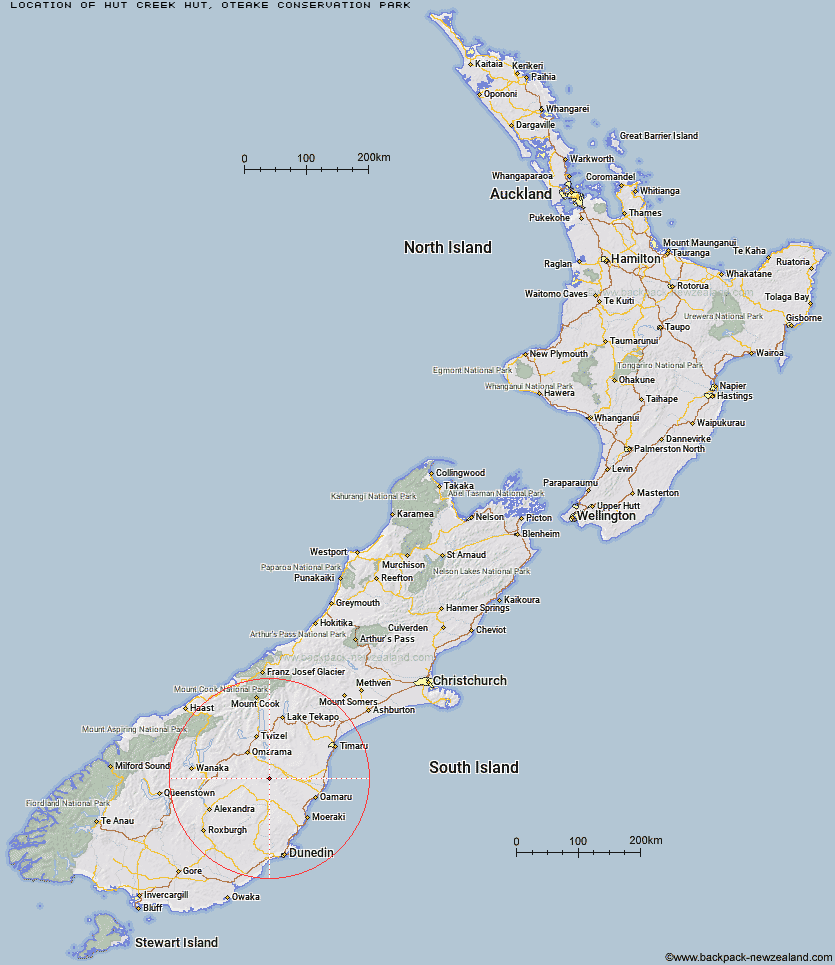
Topo Map showing location of Hut Creek Hut
This information is sourced from DoC, LINZ and Openstreetmap. Some of the hut photos are mine and the rest are from DoC. I will be adding an upload feature soon so people can photos of .Hut Creek Hut.
Basic info: Hut Creek Hut is a basic hut in the Central Otago area.
Latitude: -44.8333058183
Longitude: 170.279595849
Location: Oteake Conservation Park
Area: Otago
Type of Hut: Basic/bivvies
Tracks: Oteake Conservation Park tramping tracks
Map: CB16 Topo Map | Road Map
Does this hut still exist? Have any more information? Contact
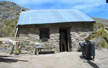
Image: DoC
Scroll down to see a topographical map and road map showing the location of Hut Creek Hut
[ A ] [ B ] [ C ] [ D ] [ E ] [ F ] [ G ] [ H ] [ I ] [ J ] [ K ] [ L ] [ M ] [ N ] [ O ] [ P ] [ Q ] [ R ] [ S ] [ T ] [ U ] [ V ] [ W ] [ Y ] [ Z ]
Closest 20 Huts to Hut Creek Hut
These are as the crow fliesTailings Hut 3.92km Brown Hut 6.24km Awakino Ski Field 6.58km Chimney Creek Hut 7.4km Ida Railway Hut 9.74km Buster Hut 9.94km Wire Yards Hut 12.95km Pearson Hut 28.22km Otamatapaio Hut 29.02km Balmoral Huts 29.2km Crumb Hut 32.39km Middle Hut 33.58km Boundary Creek Hut 35.48km Half Moon Hut 38.33km Top Hut 41.19km Mitchells Hut 41.81km Grays Hut 42.68km Mount Hut 43.98km Cayenne Hut 45.36km Gentle Annie Hut 47.33km Richmond Hut 47.76km Lauder Basin Hut 48.88km Bog Hut 50.48km Polson's Hut 55.48km Red Hut 55.5km Staircase Hut 60.05km Leaning Lodge 66.89km Burnt Bush Hut 68.55km Big Hut 68.89km Waitaki Huts 69.02km Hideaway Hut 72km Top Timaru Hut 73.6km Stodys Hut 74.06km Snowy Gorge Hut 76.62km Mae West Bivouac 76.92km Pakituhi Hut 78.12km Moonlight & Roses Hut 79.13km Junction Hut 79.83km Cotters Hut 79.91km Bush Hut 80.09km