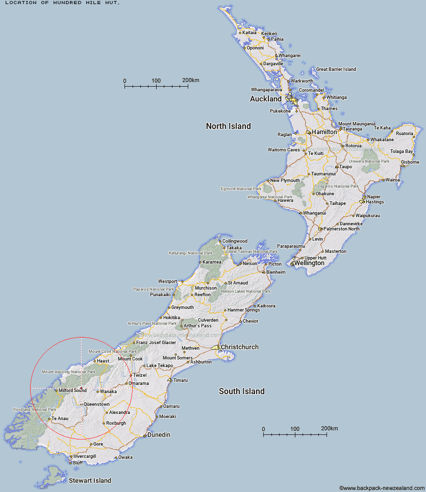
Topo Map showing location of Hundred Mile Hut
This information is sourced from DoC, LINZ and Openstreetmap. Some of the hut photos are mine and the rest are from DoC. I will be adding an upload feature soon so people can photos of .Hundred Mile Hut.
Latitude: -44.6080510261
Longitude: 168.659574349
Location:
Type of Hut:
Map: Topo Map | Road Map
Does this hut still exist? Have any more information? Contact
Latitude: -44.6080510261
Longitude: 168.659574349
Location:
Type of Hut:
Map: Topo Map | Road Map
Does this hut still exist? Have any more information? Contact
Scroll down to see a topographical map and road map showing the location of Hundred Mile Hut
[ A ] [ B ] [ C ] [ D ] [ E ] [ F ] [ G ] [ H ] [ I ] [ J ] [ K ] [ L ] [ M ] [ N ] [ O ] [ P ] [ Q ] [ R ] [ S ] [ T ] [ U ] [ V ] [ W ] [ Y ] [ Z ]
Closest 20 Huts to Hundred Mile Hut
These are as the crow fliesLochnagar Hut 3.44km Tummel Burn Hut 4.46km Sixteen Mile Huts 7.21km Shiel Burn Hut 10.1km Polnoon Hut 10.73km Raspberry Creek Shelter 12.65km Dart Hut 12.71km Cascade Hut 12.83km Shelter Rock Hut 13.13km Black Peak Hut 13.31km Cabin Hut 13.58km Aspiring Hut 14.56km Twenty Five Mile Hut 15.4km Ballarat Hut - Flood Burn 15.9km Earnslaw Hut 16.85km Saddle Hut 18.05km Liverpool Hut 19.67km Bullendale Hut 19.99km Esquilant Bivvy Hut 20.01km French Ridge Hut 20.13km Archie's Hut - Copper Creek 20.98km Scotts Rock Bivouac 21.06km Dynamo Hut 21.49km Arawhata Rock Bivouac 22km Daleys Flat Hut 23.55km Rock of Ages Bivouac 24.34km Crystal Hut 24.77km Peats Hut 25.13km Colin Todd Hut 26.39km Sainsburys Huts 26.99km Roses Hut 27.11km Stoney Creek Hut 27.35km Highland Creek Hut 28.96km Fern Burn Hut 29.57km McIntosh Hut 29.6km Wallers Hut 30.53km McIntyre's Hut 30.67km Heather Jock Hut 31.77km Jean Hut 32.12km Kelly's Hut 32.27km