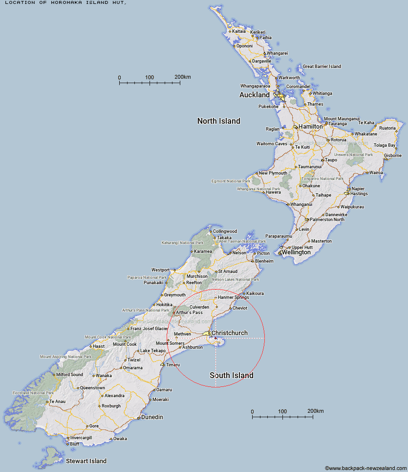
Topo Map showing location of Horomaka Island Hut
This information is sourced from DoC, LINZ and Openstreetmap. Some of the hut photos are mine and the rest are from DoC. I will be adding an upload feature soon so people can photos of .Horomaka Island Hut.
Latitude: -43.6497030862
Longitude: 172.831172103
Location:
Type of Hut:
Map: Topo Map | Road Map
Does this hut still exist? Have any more information? Contact
Latitude: -43.6497030862
Longitude: 172.831172103
Location:
Type of Hut:
Map: Topo Map | Road Map
Does this hut still exist? Have any more information? Contact
Scroll down to see a topographical map and road map showing the location of Horomaka Island Hut
[ A ] [ B ] [ C ] [ D ] [ E ] [ F ] [ G ] [ H ] [ I ] [ J ] [ K ] [ L ] [ M ] [ N ] [ O ] [ P ] [ Q ] [ R ] [ S ] [ T ] [ U ] [ V ] [ W ] [ Y ] [ Z ]
Closest 20 Huts to Horomaka Island Hut
These are as the crow fliesHoromaka Island Hut 0km Rod Donald Hut 8.31km Mount Herbert Shelter 9.21km Quail Shelter 10.82km Packhorse Hut 12.58km Pinchgut Hut 70.27km Bob's Camp Bivouac 71.32km Adams Hut 71.39km Wharfedale Hut 81.26km Tommys Cabin 82.11km Lilburne Hut 84.54km Black Hill Hut 84.71km Kinnebrooks Hut 84.81km Youngman Stream Hut 86.99km Walker Hut 87.25km Tarn Hut 87.49km Lower Salmon Creek Bivouac 87.56km Petticoat Junction Hut 89.83km Hamilton Hut 91.49km Puketeraki Bivouac 91.54km Benmore Hut 92.12km Rosa Hut 92.31km Seldom Inn Hut 93.18km Cattle Creek Hut 93.99km Broken River Hut 95.25km Esk Bivouac 97.28km Anna Hut 98.59km Anderson's Hut 99.52km Ant Stream Hut 103.04km Glenrae Hut 103.56km Lochinvar Hut 103.78km Deep Creek Hut 104.6km Ant Stream Bivouac 105.4km Bush Hut 105.79km Cold Stream Hut 107.09km Turnbull Bivouac 107.35km Bush Camp Hut 108.2km Bull Creek Hut 109.35km Cutty Grass Hut 109.88km Valley Camp Hut 110.5km