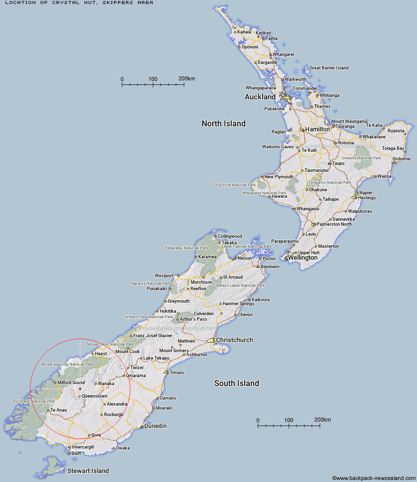
Topo Map showing location of Crystal Hut
This information is sourced from DoC, LINZ and Openstreetmap. Some of the hut photos are mine and the rest are from DoC. I will be adding an upload feature soon so people can photos of .Crystal Hut.
Basic info: basic four-bunk hut in the Queenstown/Wakatipu area.
Latitude: -44.8307067291
Longitude: 168.667540592
Location: Skippers area
Area: Otago
Type of Hut: Basic/bivvies
Map: CB11 Topo Map | Road Map
Does this hut still exist? Have any more information? Contact
Basic info: basic four-bunk hut in the Queenstown/Wakatipu area.
Latitude: -44.8307067291
Longitude: 168.667540592
Location: Skippers area
Area: Otago
Type of Hut: Basic/bivvies
Map: CB11 Topo Map | Road Map
Does this hut still exist? Have any more information? Contact
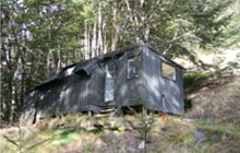
Image: DoC
Scroll down to see a topographical map and road map showing the location of Crystal Hut
[ A ] [ B ] [ C ] [ D ] [ E ] [ F ] [ G ] [ H ] [ I ] [ J ] [ K ] [ L ] [ M ] [ N ] [ O ] [ P ] [ Q ] [ R ] [ S ] [ T ] [ U ] [ V ] [ W ] [ Y ] [ Z ]
Closest 20 Huts to Crystal Hut
These are as the crow fliesCrystal Hut 0km Sainsburys Huts 2.29km Dynamo Hut 3.3km Peats Hut 4.18km Archie's Hut - Copper Creek 4.53km Bullendale Hut 4.82km Stoney Creek Hut 6.62km Green Gate Huts 7.81km Ballarat Hut - Flood Burn 8.9km Butchers Hut 11.36km Wallers Hut 14.68km Eight Mile Hut 15.04km Kelly's Hut 15.07km Roses Hut 15.67km McIntosh Hut 16.65km Heather Jock Hut 16.91km Cabin Hut 17.43km Bonnie Jean Hut 17.5km Shiel Burn Hut 17.5km McIntyre's Hut 17.62km Sixteen Mile Huts 17.63km Jean Hut 17.65km Polnoon Hut 21.01km Highland Creek Hut 22.53km Hundred Mile Hut 24.77km Twenty Five Mile Hut 26.25km Sam Summers Hut 26.39km Lochnagar Hut 26.4km Fern Burn Hut 26.97km Saddle Hut 27.67km Black Peak Hut 28.78km Earnslaw Hut 29.02km Tummel Burn Hut 29.15km Esquilant Bivvy Hut 31.57km Mid Caples Hut 31.82km Home Hill Hut 32.04km Meg Hut 32.08km Shelter Rock Hut 32.74km Glen Roy Raceman's Hut 32.83km Routeburn Shelter 33.14km