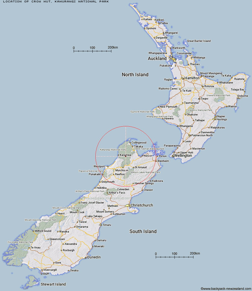
Topo Map showing location of Crow Hut
This information is sourced from DoC, LINZ and Openstreetmap. Some of the hut photos are mine and the rest are from DoC. I will be adding an upload feature soon so people can photos of .Crow Hut.
Basic info: standard 12-bunk hut in the Motueka area.
Latitude: -41.2934499196
Longitude: 172.468715593
Location: Kahurangi National Park
Area: Nelson/Tasman
Type of Hut: Standard
Tracks: Leslie-Karamea Track
Map: BQ23 Topo Map | Road Map
Does this hut still exist? Have any more information? Contact
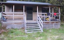
Image: DoC
Scroll down to see a topographical map and road map showing the location of Crow Hut
[ A ] [ B ] [ C ] [ D ] [ E ] [ F ] [ G ] [ H ] [ I ] [ J ] [ K ] [ L ] [ M ] [ N ] [ O ] [ P ] [ Q ] [ R ] [ S ] [ T ] [ U ] [ V ] [ W ] [ Y ] [ Z ]
Closest 20 Huts to Crow Hut
These are as the crow fliesVenus Hut 3.57km Thor Hut 7.1km Karamea Bend Hut 7.59km Flanagans Hut 10.51km Roaring Lion Hut 11.02km Kiwi Saddle Hut 12.82km Trevor Carter Hut 13.35km John Reid Hut 13.85km Stone Hut 14.35km Kākāpō Hut 14.46km Splugeons Rock Shelter 15.26km Helicopter Flat Hut 16.33km Greys Hut 17.22km Taipo Hut 17.39km Stag Flat Shelter 18.44km Wangapeka Bivouac 18.67km Balloon Hut 18.88km Kings Creek Hut 19.16km Ellis Hut 19.17km Cecil Kings Hut 19.32km Belltown Manunui Hut 20.34km Dry Rock Shelter 20.54km Trilobite Hut 21.62km Myttons Hut 21.7km Growler Rock Shelter 22.25km Mt Arthur Hut 23.23km Upper Gridiron Hut and Rock Shelters 23.45km Chaffey Hut 23.68km Adams Flat Hut 23.92km Hurricane Hut 24.78km Flora Hut 25.08km Johnson Hut 25.15km Sylvester Hut 25.49km Branch Creek Hut 25.86km Tent Camp 25.9km Asbestos Cottage 26.08km Sunshine Flat Shelter 26.13km Granity Pass Hut 26.67km Cobb Hut 26.83km Fenella Hut 27.52km