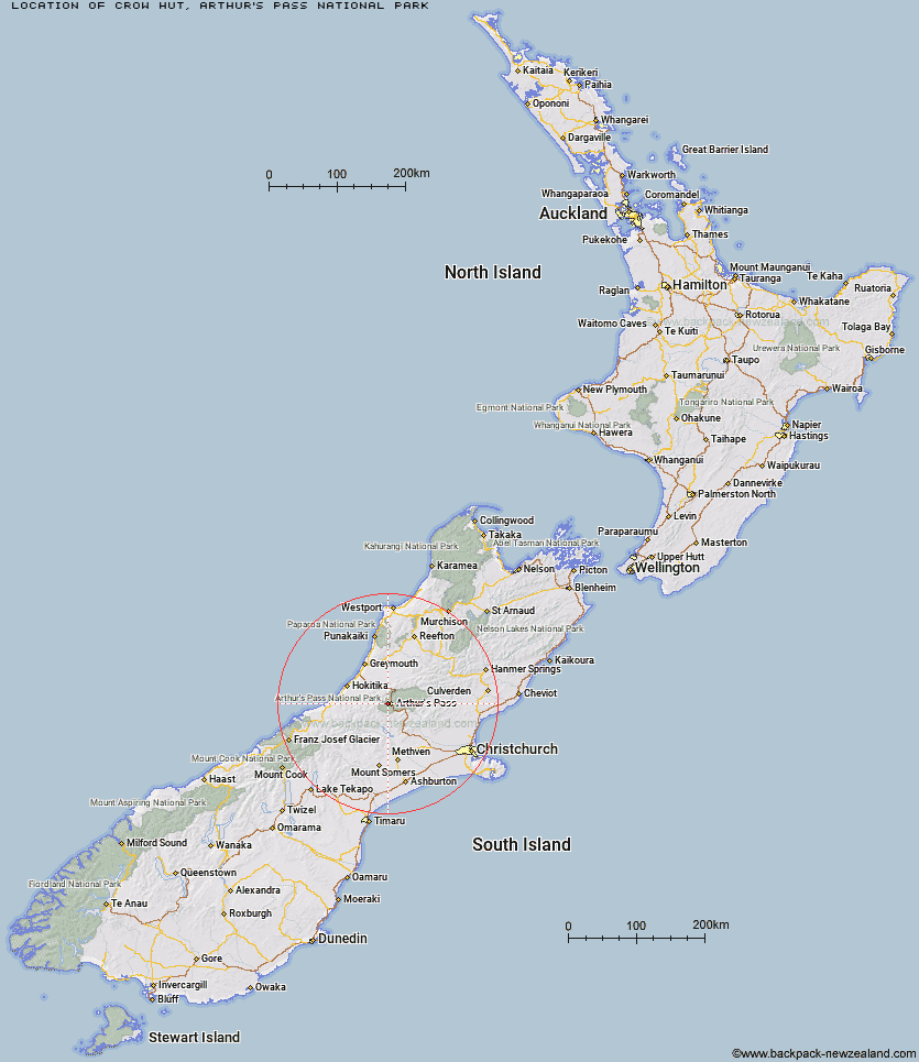
Topo Map showing location of Crow Hut
This information is sourced from DoC, LINZ and Openstreetmap. Some of the hut photos are mine and the rest are from DoC. I will be adding an upload feature soon so people can photos of .Crow Hut.
Basic info: standard 10-bunk hut in the North Canterbury and Arthur's Pass area.
Latitude: -42.9434561704
Longitude: 171.517050611
Location: Arthur's Pass National Park
Area: Canterbury
Type of Hut: Standard
Tracks: Avalanche Peak - Crow River Route
Map: BV20 Topo Map | Road Map
Does this hut still exist? Have any more information? Contact
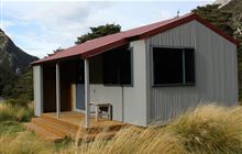
Image: DoC
Scroll down to see a topographical map and road map showing the location of Crow Hut
[ A ] [ B ] [ C ] [ D ] [ E ] [ F ] [ G ] [ H ] [ I ] [ J ] [ K ] [ L ] [ M ] [ N ] [ O ] [ P ] [ Q ] [ R ] [ S ] [ T ] [ U ] [ V ] [ W ] [ Y ] [ Z ]
Closest 20 Huts to Crow Hut
These are as the crow fliesWaimakariri Falls Hut 3.74km Jacks Hut 4.32km Carrington Hut 5.88km Anti Crow Hut 6.27km Greyneys Shelter 7.49km Klondyke Shelter 8.79km Old Julia Hut 9.02km Julia Hut 9.09km Mingha Bivouac 9.48km Goat Pass Hut 9.94km Upper Deception Hut 10.48km Edwards Hut 10.66km Bealey Spur Hut 10.85km Barker Hut 10.95km Hunts Creek Hut 11.49km Mid Taipo Hut 11.99km Campbell Bivouac 14.04km Dunns Creek Hut 14.08km Avoca Hut 14.1km Lagoon Saddle Hut 14.14km Lagoon Saddle A Frame Hut 14.2km Mudflats Hut 14.32km Bealey Hut 14.58km Park Morpeth Hut 14.6km Sudden Valley Bivouac 15.28km Newton Creek Hut 16.06km Harman Hut 16.13km Carroll Hut 17.25km Back Basin Hide 17.35km Scottys Bivouac 17.4km Old Basins Hut 17.65km Dillon Hut 17.67km Basins Hut 17.85km Hawdon Hut 17.92km Dillons Homestead Hut 17.98km Otehake Hut 18.44km West Harper Hut 18.86km Weka Burnet Bivouac 18.98km Urquhart's Hut 19.14km Grassy Flat Hut 19.19km