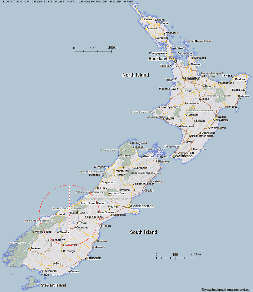
Topo Map showing location of Creswicke Flat Hut
This information is sourced from DoC, LINZ and Openstreetmap. Some of the hut photos are mine and the rest are from DoC. I will be adding an upload feature soon so people can photos of .Creswicke Flat Hut.
Basic info: basic four-bunk hut in the South Westland area.
Latitude: -43.9230315848
Longitude: 169.688924758
Location: Landsborough River area
Area: West Coast
Type of Hut: Basic/bivvies
Map: BY14 Topo Map | Road Map
Does this hut still exist? Have any more information? Contact
Basic info: basic four-bunk hut in the South Westland area.
Latitude: -43.9230315848
Longitude: 169.688924758
Location: Landsborough River area
Area: West Coast
Type of Hut: Basic/bivvies
Map: BY14 Topo Map | Road Map
Does this hut still exist? Have any more information? Contact
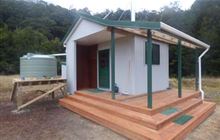
Image: DoC
Scroll down to see a topographical map and road map showing the location of Creswicke Flat Hut
[ A ] [ B ] [ C ] [ D ] [ E ] [ F ] [ G ] [ H ] [ I ] [ J ] [ K ] [ L ] [ M ] [ N ] [ O ] [ P ] [ Q ] [ R ] [ S ] [ T ] [ U ] [ V ] [ W ] [ Y ] [ Z ]
Closest 20 Huts to Creswicke Flat Hut
These are as the crow fliesBrodrick Hut 6.6km Main Huxley Forks Hut 10.36km Elcho Hut 11.36km Cullers Hut 11.82km Dasler Bivouac 13.11km Red Hut 14.33km South Huxley Bivouac 14.36km Monument Hut 14.93km Forbes Hut 15.05km Dodger Hut 15.53km Tunnel Creek Hut 16.84km Erceg Hut 20.05km Grough Hut 20.68km Le Crens Hut 21.31km Richardson Rock Bivouac 21.39km Middle Head Hut 21.76km Top Hut 22.22km Wills Hut 22.26km Station Hut 22.26km Kennedy Hut 22.52km South Temple Hut 23.88km Ferguson Hut 24.49km Horseshoe Flat Hut 25.4km Stony Stream Bivouac 25.7km Waterfall Hut 26.04km Hagens Hut 26.14km Lame Duck Hut 27.97km Reardon Hut 28.23km Brewster Hut 28.73km Bull Flat Hut 28.78km Christmas Flat Hut 28.8km Roaring Billy Hut 29.48km Makarora Hut 30.34km Barron Saddle Hut 30.94km Blue River (Blowfly) Hut 31.09km Cassel Flat Hut 31.43km Scrubby Hut 31.75km Shamrock Hut 32.02km Whale Stream Hut 32.03km Horace Walker Hut 32.08km