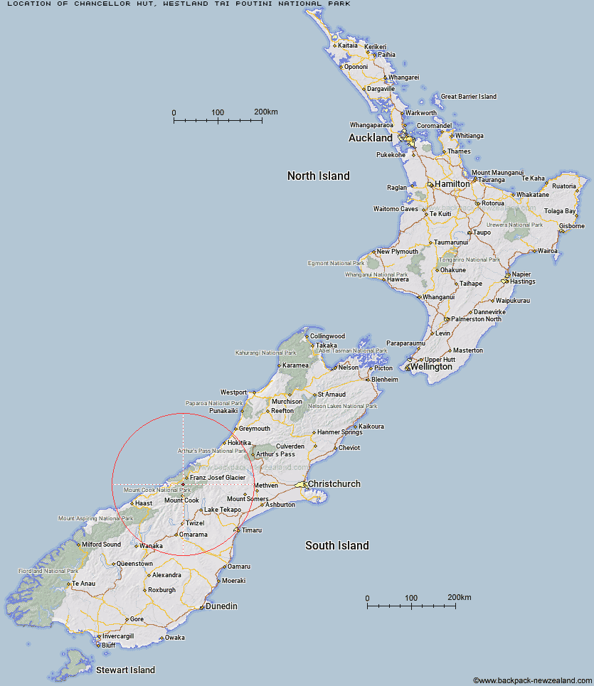
Topo Map showing location of Chancellor Hut
This information is sourced from DoC, LINZ and Openstreetmap. Some of the hut photos are mine and the rest are from DoC. I will be adding an upload feature soon so people can photos of .Chancellor Hut.
Basic info: Chancellor Hut is the oldest alpine hut still on its original site. It was carried in piece by piece and assembled on site, in the days before alpine air lifts.
Latitude: -43.5103255067
Longitude: 170.108494905
Location: Westland Tai Poutini National Park
Area: West Coast
Type of Hut: Serviced Alpine
Map: BX15 Topo Map | Road Map
Does this hut still exist? Have any more information? Contact
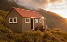
Image: DoC
Scroll down to see a topographical map and road map showing the location of Chancellor Hut
[ A ] [ B ] [ C ] [ D ] [ E ] [ F ] [ G ] [ H ] [ I ] [ J ] [ K ] [ L ] [ M ] [ N ] [ O ] [ P ] [ Q ] [ R ] [ S ] [ T ] [ U ] [ V ] [ W ] [ Y ] [ Z ]
Closest 20 Huts to Chancellor Hut
These are as the crow fliesPioneer Hut 6.46km Castle Rocks Hut 7.92km Almer Hut 9km Empress Hut 9.44km Centennial Hut 10.12km Plateau Hut 10.18km Hende's Hut 10.26km Haast Hut 10.74km Ball Hut 14.35km Caroline Hut 14.83km Spencer Rock Bivouac 15.38km Copland Shelter 16.11km Douglas Rock Hut 17.45km Welcome Flat Campsite 18.67km Welcome Flat Hut 18.68km Tasman Saddle Hut 18.83km Onslow Hut (Steffan Memorial Hut) 19.42km Sefton Bivvy 19.92km Kelman Hut 20.39km Stocking Stream Shelter 20.94km Liebig Hut 20.95km Architect Creek Hut 21.12km Whymper Hut 22.54km Murchison Hut 23.07km Mueller Hut 23.68km Harpers Rock Bivouac 24.16km Horace Walker Hut 24.87km Butler Junction Hut 27.2km Cassel Flat Hut 28.04km Christmas Flat Hut 28.17km Top Butler Hut 28.59km Littles Hut 28.77km Memorial Hut 28.98km Barron Saddle Hut 28.99km Lame Duck Hut 29.25km Stan's Hut 29.34km Birdcage Hut 29.57km Eade Memorial Hut 30.13km Rankin Hut 31.31km Red Stag Hut 31.94km