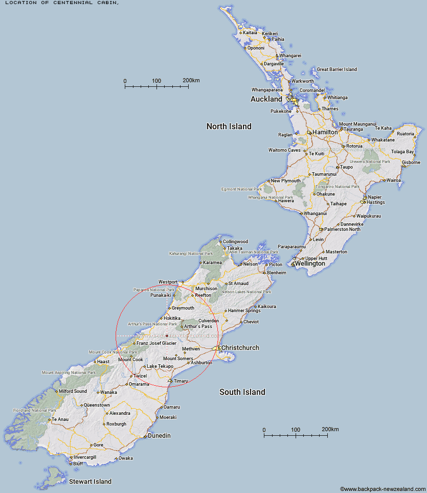
Topo Map showing location of Centennial Cabin
This information is sourced from DoC, LINZ and Openstreetmap. Some of the hut photos are mine and the rest are from DoC. I will be adding an upload feature soon so people can photos of .Centennial Cabin.
Latitude: -43.1814980442
Longitude: 171.124722472
Location:
Type of Hut:
Map: Topo Map | Road Map
Does this hut still exist? Have any more information? Contact
Latitude: -43.1814980442
Longitude: 171.124722472
Location:
Type of Hut:
Map: Topo Map | Road Map
Does this hut still exist? Have any more information? Contact
Scroll down to see a topographical map and road map showing the location of Centennial Cabin
[ A ] [ B ] [ C ] [ D ] [ E ] [ F ] [ G ] [ H ] [ I ] [ J ] [ K ] [ L ] [ M ] [ N ] [ O ] [ P ] [ Q ] [ R ] [ S ] [ T ] [ U ] [ V ] [ W ] [ Y ] [ Z ]
Closest 20 Huts to Centennial Cabin
These are as the crow fliesMathias Hut 0.83km Moraine Hut 1.42km West Mathias Bivouac 3.29km Canyon Creek Bivouac 8.55km Jellicoe Hut 11.09km Wilkinson Hut 11.28km Neave Hut 11.53km Evans Hut 11.55km Frew Saddle Bivouac 11.94km Price Flat Hut 12.4km Moa Stream Hut 12.47km Price Flat Hut 12.61km Washbourne Hut 13.5km Sir Robert Hut 13.88km Banfield Hut 14.15km Price Basin Hut 14.22km Thompsons Hut 14.53km Bluff Hut 14.98km Frew Hut 16.09km Lauper Bivouac 16.15km Poet Hut 16.34km Frisco Hut 16.7km Downs Hut 16.82km Reischek Hut 17km Unknown Stream Hut 17.64km Toaroha Saddle Bivouac 17.81km Ivory Lake Hut 17.9km Moa Hut 17.95km Mungo Hut 18.26km Top Toaroha Hut 18.84km Serpentine Hut 19.04km Manuels Hut 19.42km Mullins Hut 20.55km Crystal Bivouac 20.7km Fanghill Hut 20.82km Top Waitaha Hut 20.89km Rapid Creek Hut 21.05km Top Tuke Hut 21.66km Lyell Hut 21.78km Yeats Ridge Hut 22.01km