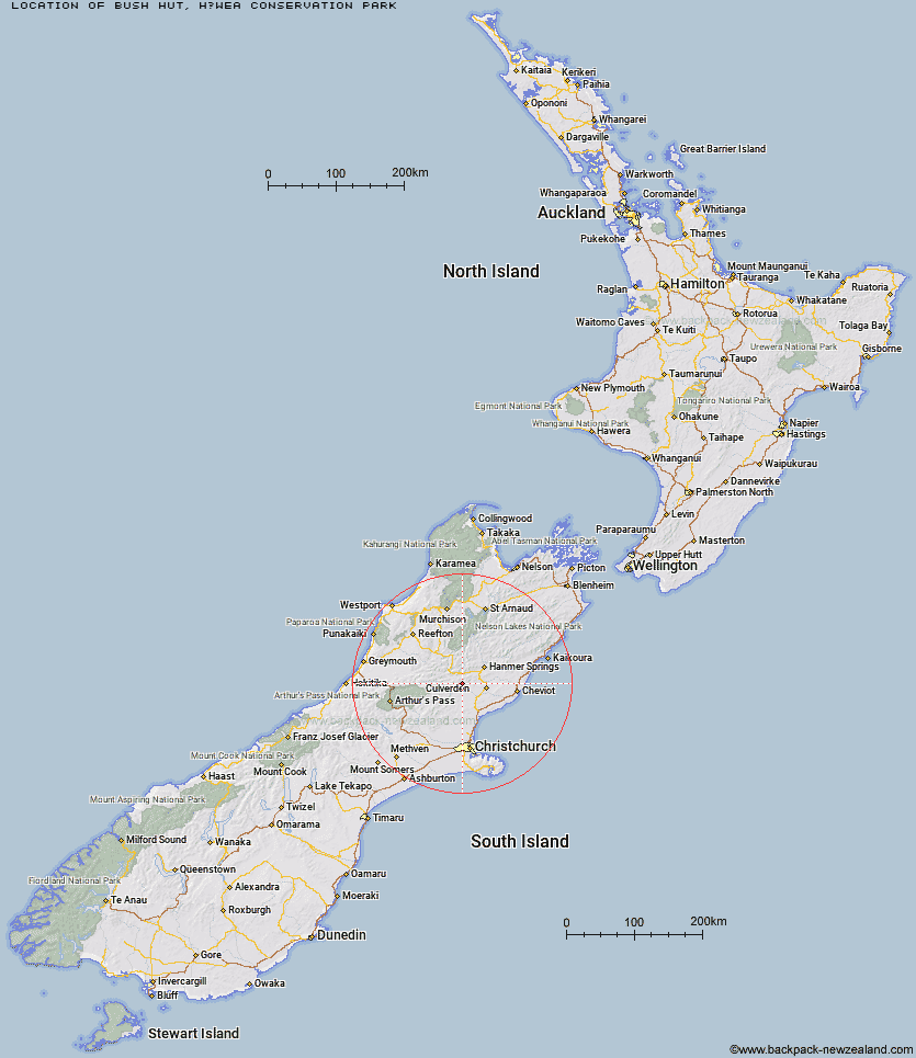
Topo Map showing location of Bush Hut
This information is sourced from DoC, LINZ and Openstreetmap. Some of the hut photos are mine and the rest are from DoC. I will be adding an upload feature soon so people can photos of .Bush Hut.
Basic info: standard six-bunk hut in the Wanaka/Makarora area.
Latitude: -42.721848707
Longitude: 172.542621267
Location: Hāwea Conservation Park
Area: Otago
Type of Hut: Standard
Tracks: Dingle Burn Track
Map: CA13 Topo Map | Road Map
Does this hut still exist? Have any more information? Contact
Basic info: standard six-bunk hut in the Wanaka/Makarora area.
Latitude: -42.721848707
Longitude: 172.542621267
Location: Hāwea Conservation Park
Area: Otago
Type of Hut: Standard
Tracks: Dingle Burn Track
Map: CA13 Topo Map | Road Map
Does this hut still exist? Have any more information? Contact
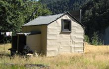
Image: DoC
Scroll down to see a topographical map and road map showing the location of Bush Hut
[ A ] [ B ] [ C ] [ D ] [ E ] [ F ] [ G ] [ H ] [ I ] [ J ] [ K ] [ L ] [ M ] [ N ] [ O ] [ P ] [ Q ] [ R ] [ S ] [ T ] [ U ] [ V ] [ W ] [ Y ] [ Z ]
Closest 20 Huts to Bush Hut
These are as the crow fliesValley Camp Hut 5.1km Glenrae Bivouac 8.71km Glenrae Hut 10.07km Cold Stream Hut 13.34km Jollie Brook Hut 17.06km Carlyle Hut 19.46km Tutu Hut 19.76km Bus Shelter 20.32km Gabriel Hut 20.65km Evangeline Bivouac 22km Hope Halfway Hut 23.23km Museum Hut 25.52km Magdalen Hut 25.58km Tommys Cabin 26.57km Steyning Hut 28.11km Saint Jacob's Hut 28.22km Tin Jug Hut 28.59km Seldom Inn Hut 28.82km Boyle Flat Hut 29.28km Stony Stream Bivouac 29.57km Deep Creek Hut 29.87km Doubtful Hut 30km Lake Mason Hut 30.85km Lake Man Bivouac 32.31km Lake Sumner Hut 32.35km Three Mile Stream Hut 32.44km Esk Bivouac 32.48km Rokeby Hut 32.69km Bush Camp Hut 32.78km Devils Den Bivouac 33.02km Top Hope Hut 33.42km Scotties Hut 33.44km Nina Hut 33.71km Doubtless Hut 34.12km Jervois Hut 34.19km Upper Nina Bivouac 35.74km Stony Stream Hut 35.77km Lucretia Hut 36.42km Old Bridge Hut 36.46km Hurunui Hut 36.54km