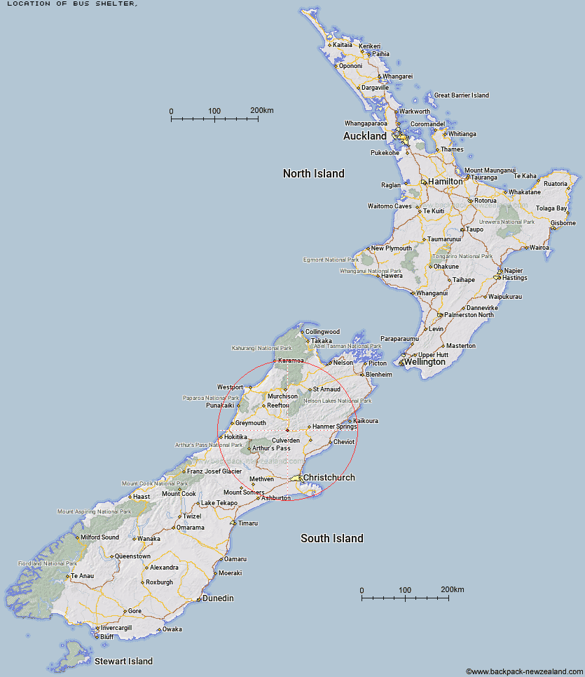
Topo Map showing location of Bus Shelter
This information is sourced from DoC, LINZ and Openstreetmap. Some of the hut photos are mine and the rest are from DoC. I will be adding an upload feature soon so people can photos of .Bus Shelter.
Latitude: -42.5853769912
Longitude: 172.377385187
Location:
Type of Hut:
Map: Topo Map | Road Map
Does this hut still exist? Have any more information? Contact
Latitude: -42.5853769912
Longitude: 172.377385187
Location:
Type of Hut:
Map: Topo Map | Road Map
Does this hut still exist? Have any more information? Contact
Scroll down to see a topographical map and road map showing the location of Bus Shelter
[ A ] [ B ] [ C ] [ D ] [ E ] [ F ] [ G ] [ H ] [ I ] [ J ] [ K ] [ L ] [ M ] [ N ] [ O ] [ P ] [ Q ] [ R ] [ S ] [ T ] [ U ] [ V ] [ W ] [ Y ] [ Z ]
Closest 20 Huts to Bus Shelter
These are as the crow fliesHope Halfway Hut 7.33km Doubtful Hut 9.79km Carlyle Hut 10.45km Museum Hut 11.13km Saint Jacob's Hut 11.75km Magdalen Hut 12.64km Devils Den Bivouac 12.81km Lake Man Bivouac 13.11km Glenrae Bivouac 13.28km Evangeline Bivouac 13.48km Nina Hut 14.04km Doubtless Hut 14.25km Boyle Flat Hut 14.97km Jollie Brook Hut 15.38km Upper Nina Bivouac 15.5km Top Hope Hut 16.53km Gabriel Hut 16.72km Cold Stream Hut 17.64km Valley Camp Hut 17.66km Lucretia Hut 17.75km Rokeby Hut 18.29km Brass Monkey Bivouac 19.13km Tutu Hut 19.15km Lake Christabel Hut 19.28km Steyning Hut 19.64km Three Mile Stream Hut 19.82km Top Robinson Hut 20.14km Bush Hut 20.32km Glenrae Hut 20.45km Tin Jug Hut 20.9km Lake Sumner Hut 23.22km Lake Mason Hut 24.31km Slaty Creek Hut 24.38km Stony Stream Bivouac 24.64km Jervois Hut 25.05km Mid Robinson Hut 25.85km Mackenzie Bivouac 26.46km Hurunui Hut 26.51km Scotties Hut 27.62km Anne Cullers Hut 28km