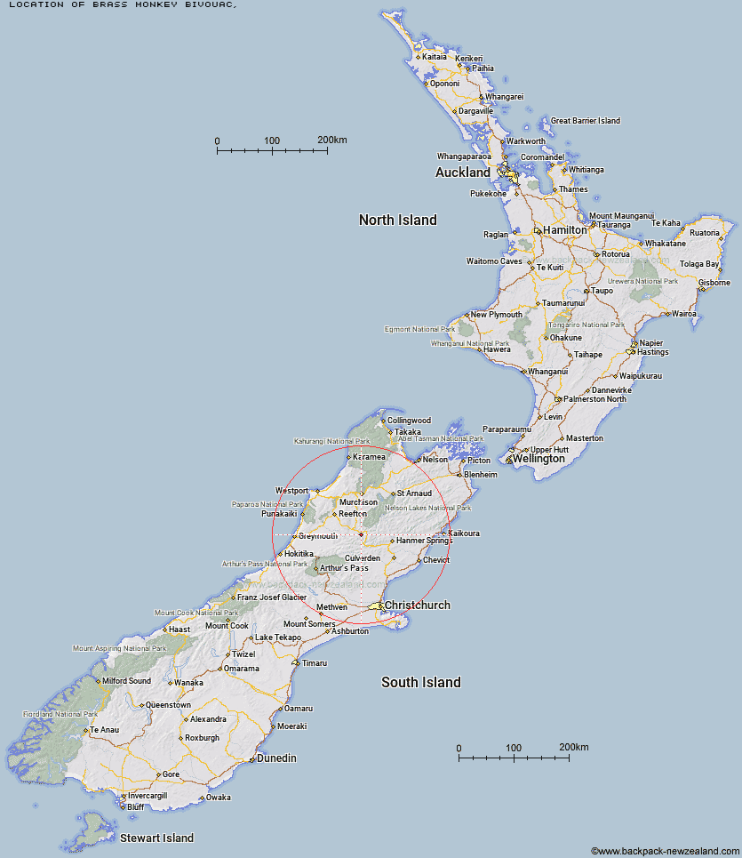
Topo Map showing location of Brass Monkey Bivouac
This information is sourced from DoC, LINZ and Openstreetmap. Some of the hut photos are mine and the rest are from DoC. I will be adding an upload feature soon so people can photos of .Brass Monkey Bivouac.
Latitude: -42.4194167631
Longitude: 172.316038893
Location:
Type of Hut:
Map: Topo Map | Road Map
Does this hut still exist? Have any more information? Contact
Latitude: -42.4194167631
Longitude: 172.316038893
Location:
Type of Hut:
Map: Topo Map | Road Map
Does this hut still exist? Have any more information? Contact
Scroll down to see a topographical map and road map showing the location of Brass Monkey Bivouac
[ A ] [ B ] [ C ] [ D ] [ E ] [ F ] [ G ] [ H ] [ I ] [ J ] [ K ] [ L ] [ M ] [ N ] [ O ] [ P ] [ Q ] [ R ] [ S ] [ T ] [ U ] [ V ] [ W ] [ Y ] [ Z ]
Closest 20 Huts to Brass Monkey Bivouac
These are as the crow fliesLucretia Hut 2.81km Nina Hut 5.18km Lake Christabel Hut 5.36km Upper Nina Bivouac 6.64km Devils Den Bivouac 7.81km Pell Stream Hut 10.66km Rokeby Hut 12.21km Doubtful Hut 12.71km Manson-Nicholls Memorial Hut 12.91km Boyle Flat Hut 12.93km Top Robinson Hut 12.98km Doubtless Hut 13.59km Cannibal Gorge Hut 13.93km Magdalen Hut 15.64km Lake Man Bivouac 16.23km Ada Pass Hut 17.26km Anne Cullers Hut 17.93km Anne Hut 19.06km Bus Shelter 19.13km Steyning Hut 20.61km Carlyle Hut 20.71km Mid Robinson Hut 21km Jervois Hut 21.52km Saint Jacob's Hut 21.64km Tin Jug Hut 21.81km Hope Halfway Hut 21.88km Top Hope Hut 22.17km Slaty Creek Hut 23.56km Museum Hut 24km Lake Stream Hut 24.35km Pool Hut 24.73km Old Bridge Hut 24.93km Christopher Cullers Hut 24.98km Christopher Hut 25.11km Bobs Hut 25.87km Stony Stream Bivouac 26.11km Scotties Hut 26.61km Tutu Hut 27.91km Top Waitahu Bivouac 29.39km Evangeline Bivouac 29.41km