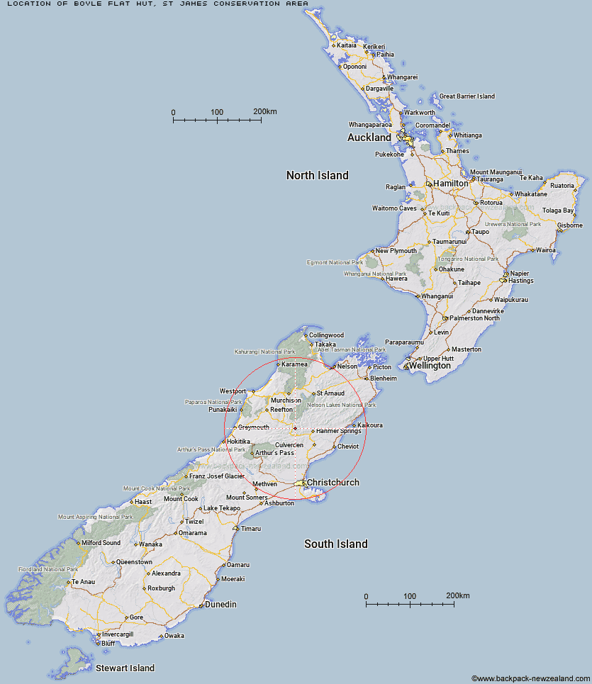
Topo Map showing location of Boyle Flat Hut
This information is sourced from DoC, LINZ and Openstreetmap. Some of the hut photos are mine and the rest are from DoC. I will be adding an upload feature soon so people can photos of .Boyle Flat Hut.
Basic info: serviced 12-bunk hut in the St James Conservation Area.
Latitude: -42.4655339595
Longitude: 172.460635412
Location: St James Conservation Area
Area: Canterbury
Type of Hut: Serviced
Tracks: St James Walkway
Map: BT23 Topo Map | Road Map
Does this hut still exist? Have any more information? Contact
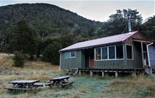
Image: DoC
Scroll down to see a topographical map and road map showing the location of Boyle Flat Hut
[ A ] [ B ] [ C ] [ D ] [ E ] [ F ] [ G ] [ H ] [ I ] [ J ] [ K ] [ L ] [ M ] [ N ] [ O ] [ P ] [ Q ] [ R ] [ S ] [ T ] [ U ] [ V ] [ W ] [ Y ] [ Z ]
Closest 20 Huts to Boyle Flat Hut
These are as the crow fliesRokeby Hut 3.55km Magdalen Hut 3.72km Steyning Hut 8km Tin Jug Hut 9.32km Carlyle Hut 9.86km Lucretia Hut 10.14km Jervois Hut 11.13km Nina Hut 11.36km Brass Monkey Bivouac 12.93km Anne Cullers Hut 13.08km Stony Stream Bivouac 13.77km Devils Den Bivouac 13.86km Anne Hut 13.9km Pool Hut 14.89km Old Bridge Hut 14.92km Bus Shelter 14.97km Tutu Hut 15.23km Scotties Hut 15.24km Upper Nina Bivouac 15.47km Cannibal Gorge Hut 15.65km Doubtful Hut 16.27km Lake Christabel Hut 17.14km Ada Pass Hut 17.9km Pell Stream Hut 18.6km Doubtless Hut 20.23km Hope Halfway Hut 21.37km Lake Man Bivouac 21.43km Christopher Hut 21.48km Christopher Cullers Hut 21.79km Manson-Nicholls Memorial Hut 22.72km Top Robinson Hut 23.12km Stanley Vale Hut 23.35km Saint Jacob's Hut 24.04km Valley Camp Hut 24.7km Museum Hut 24.86km Lake Guyon Hut 25.14km Glenrae Bivouac 25.53km Bobs Hut 26.97km Top Hope Hut 27.14km Evangeline Bivouac 28.35km