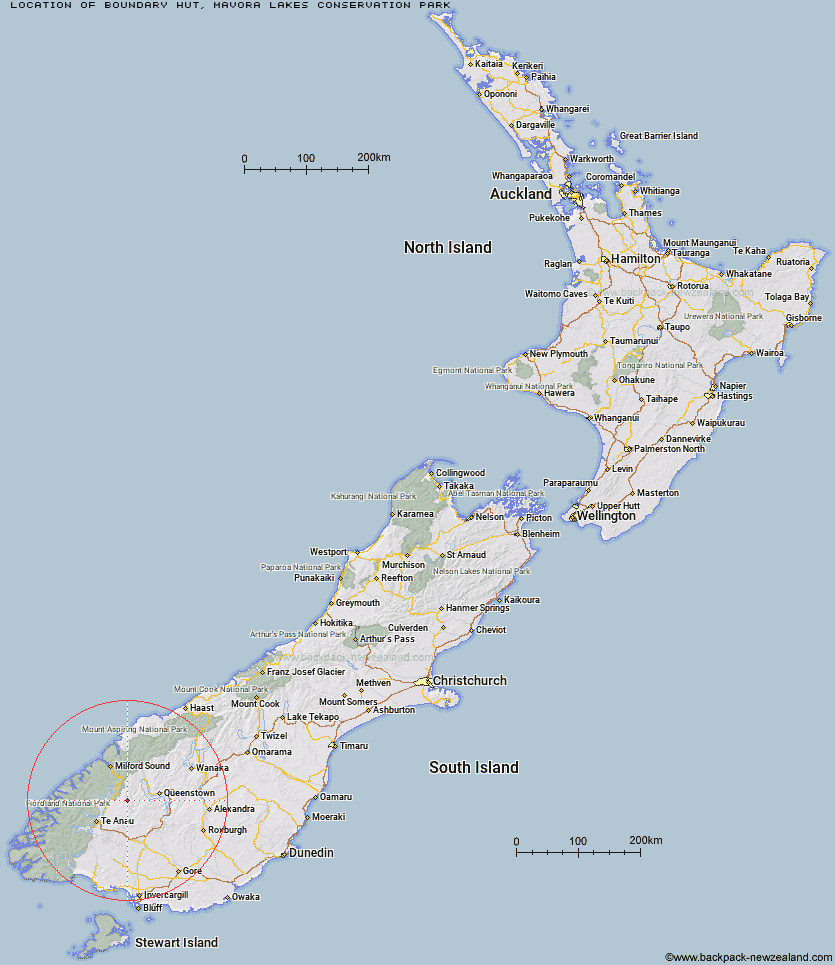
Topo Map showing location of Boundary Hut
This information is sourced from DoC, LINZ and Openstreetmap. Some of the hut photos are mine and the rest are from DoC. I will be adding an upload feature soon so people can photos of .Boundary Hut.
Basic info: standard four-bunk hut in the Te Anau area
Latitude: -45.1397205324
Longitude: 168.179583165
Location: Mavora Lakes Conservation Park
Area: Southland
Type of Hut: Standard
Tracks: This is a standard four-bunk hut in the Te Anau area
Map: Topo Map | Road Map
Does this hut still exist? Have any more information? Contact
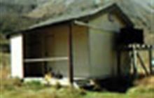
Image: DoC
Scroll down to see a topographical map and road map showing the location of Boundary Hut
[ A ] [ B ] [ C ] [ D ] [ E ] [ F ] [ G ] [ H ] [ I ] [ J ] [ K ] [ L ] [ M ] [ N ] [ O ] [ P ] [ Q ] [ R ] [ S ] [ T ] [ U ] [ V ] [ W ] [ Y ] [ Z ]
Closest 20 Huts to Boundary Hut
These are as the crow fliesForks Hut 5km Careys Hut 5.53km West Burn Hut 7.66km Taipo Hut 10.48km Army Hut 17.72km Greenstone Hut 18.99km Steele Creek Lodge 19.96km Rats Nest Hut 21.64km Slip Flat Hut 21.7km Steele Creek Hut 23.8km Kiwi Burn Hut 24.93km Home Hill Hut 26.06km Upper Oreti Hut 26.39km Saint Marys Hut 27km Lincoln Hut 28.05km Ashton Hut 28.07km Mid Caples Hut 28.52km Billy Hut 28.7km Sam Summers Hut 29.46km McKellar Hut 29.92km McKellar Lodge 30.15km Dog Box Bivouac 30.38km Glade House 31.28km Upper Caples Hut 33.06km Upper Windley Hut 33.6km Clinton Hut 33.63km Cowshed Hut 34.47km Worsley Hut 34.93km The Divide Shelter 35.35km Shepherd Creek Hut 35.43km Siberia Hut 35.54km Upper Cromel Hut 35.94km Lake Howden Hut 36.21km Long Burn Hut 36.23km Irthing Hut 36.46km Ross Hut 37.02km Islands Hut 37.58km Bonnie Jean Hut 37.72km Jean Hut 38.07km Kay Creek Hut 38.23km