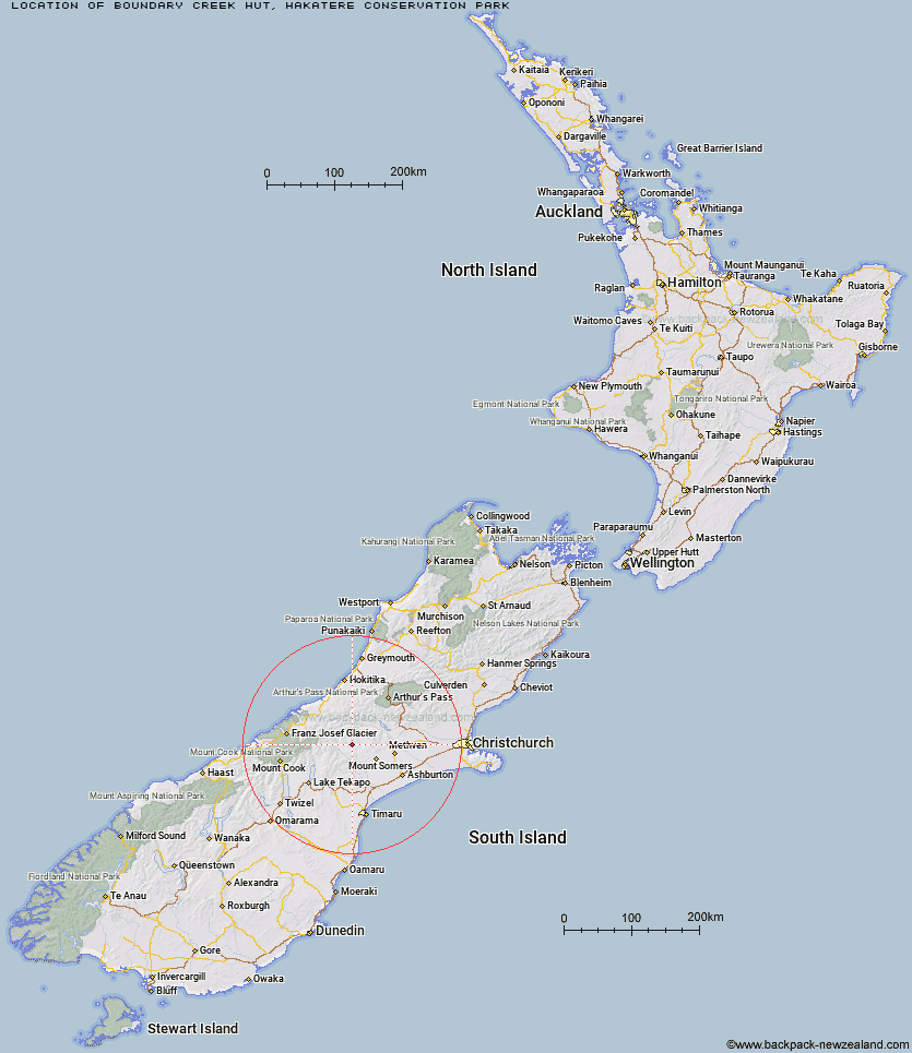
Topo Map showing location of Boundary Creek Hut
This information is sourced from DoC, LINZ and Openstreetmap. Some of the hut photos are mine and the rest are from DoC. I will be adding an upload feature soon so people can photos of .Boundary Creek Hut.
Basic info: Boundary Creek Hut is a basic hut in the Mid and South Canterbury area.
Latitude: -43.5295253422
Longitude: 171.071437104
Location: Hakatere Conservation Park
Area: Canterbury
Type of Hut: Basic/bivvies
Map: BX19 Topo Map | Road Map
Does this hut still exist? Have any more information? Contact
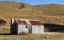
Image: DoC
Scroll down to see a topographical map and road map showing the location of Boundary Creek Hut
[ A ] [ B ] [ C ] [ D ] [ E ] [ F ] [ G ] [ H ] [ I ] [ J ] [ K ] [ L ] [ M ] [ N ] [ O ] [ P ] [ Q ] [ R ] [ S ] [ T ] [ U ] [ V ] [ W ] [ Y ] [ Z ]
Closest 20 Huts to Boundary Creek Hut
These are as the crow fliesPotts Hut 9.18km Top Hut 12.57km Highland Home 12.71km Manuka Hut 14.77km Double Hut 15.73km Charlies Hut 18.52km Cameron Hut 18.57km Lawrence Hut 19.27km Hermitage Hut 19.39km Erewhon Station Hut 20.17km Black Mountain Hut 20.21km Dog Kennel Bivouac 21.9km Woolshed Creek Hut 21.99km Downs Hut 22.29km Three Creeks Hut 23.33km Lawrence Bivouac 23.49km Thompsons Hut 24.52km Crooked Spur Hut 25.01km Taffy Hut 25.63km Banfield Hut 25.72km Comyns Hut 26.36km Watchdog Hut 26.53km Pinnacles Hut 26.61km Growler Hut 26.9km Lagoon Hut 27.48km Jellicoe Hut 27.86km Washbourne Hut 28.5km Lyell Hut 28.76km Reischek Hut 29.09km A Frame Hut 29.12km McCoy Hut 29.21km Alford Hut 29.52km Cookshop Hut 29.8km Stone Hut 29.81km Felt Hut 29.98km Evans Hut 30.18km Curtis Memorial Hut 30.21km Lauper Bivouac 30.26km Cookies Hut 30.31km Top Mount Peel Huts 31.46km