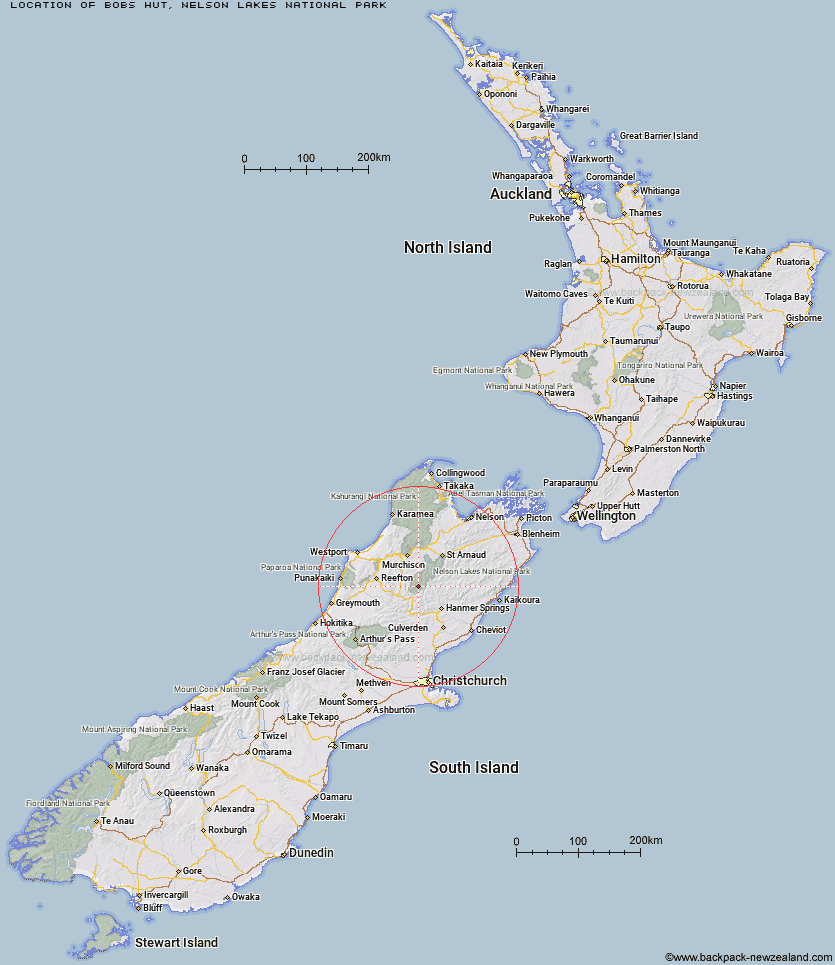
Topo Map showing location of Bobs Hut
This information is sourced from DoC, LINZ and Openstreetmap. Some of the hut photos are mine and the rest are from DoC. I will be adding an upload feature soon so people can photos of .Bobs Hut.
Basic info: standard 8-bunk hut in the Nelson Lakes area.
Latitude: -42.2237440759
Longitude: 172.486152484
Location: Nelson Lakes National Park
Area: Nelson/Tasman
Type of Hut: Standard
Map: BT23 Topo Map | Road Map
Does this hut still exist? Have any more information? Contact
Basic info: standard 8-bunk hut in the Nelson Lakes area.
Latitude: -42.2237440759
Longitude: 172.486152484
Location: Nelson Lakes National Park
Area: Nelson/Tasman
Type of Hut: Standard
Map: BT23 Topo Map | Road Map
Does this hut still exist? Have any more information? Contact
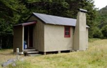
Image: DoC
Scroll down to see a topographical map and road map showing the location of Bobs Hut
[ A ] [ B ] [ C ] [ D ] [ E ] [ F ] [ G ] [ H ] [ I ] [ J ] [ K ] [ L ] [ M ] [ N ] [ O ] [ P ] [ Q ] [ R ] [ S ] [ T ] [ U ] [ V ] [ W ] [ Y ] [ Z ]
Closest 20 Huts to Bobs Hut
These are as the crow fliesEast Matakitaki Hut 6.8km Burn Creek Hut 8.06km Christopher Cullers Hut 8.85km Ada Pass Hut 9.29km Christopher Hut 9.69km Downie Hut 10.55km Cannibal Gorge Hut 12.34km Anne Hut 14.6km Nardoo Hut 14.84km Anne Cullers Hut 14.85km Lake Guyon Hut 15.11km Upper D'Urville Hut 16.18km Caroline Creek Bivouac 16.31km Pell Stream Hut 16.59km Stanley Vale Hut 17.63km Manson-Nicholls Memorial Hut 18.52km Pool Hut 21.9km George Lyon Hut 21.92km Old Bridge Hut 22.29km Jervois Hut 22.62km Blue Lake Hut 23.08km Matakitaki Base Hut 23.3km Rokeby Hut 23.42km Fowlers Hut 25.01km Lucretia Hut 25.29km Paske Hut 25.38km Brass Monkey Bivouac 25.87km Scotties Hut 26.17km Boyle Flat Hut 26.97km Tin Jug Hut 27.88km Steyning Hut 27.94km West Sabine Hut 29.02km Stony Stream Bivouac 29.12km Lake Stream Hut 29.27km Island Gully Hut 29.3km Morgan Hut 29.34km Mole Hut 30.03km Nina Hut 30.1km Lake Christabel Hut 30.39km Magdalen Hut 30.43km