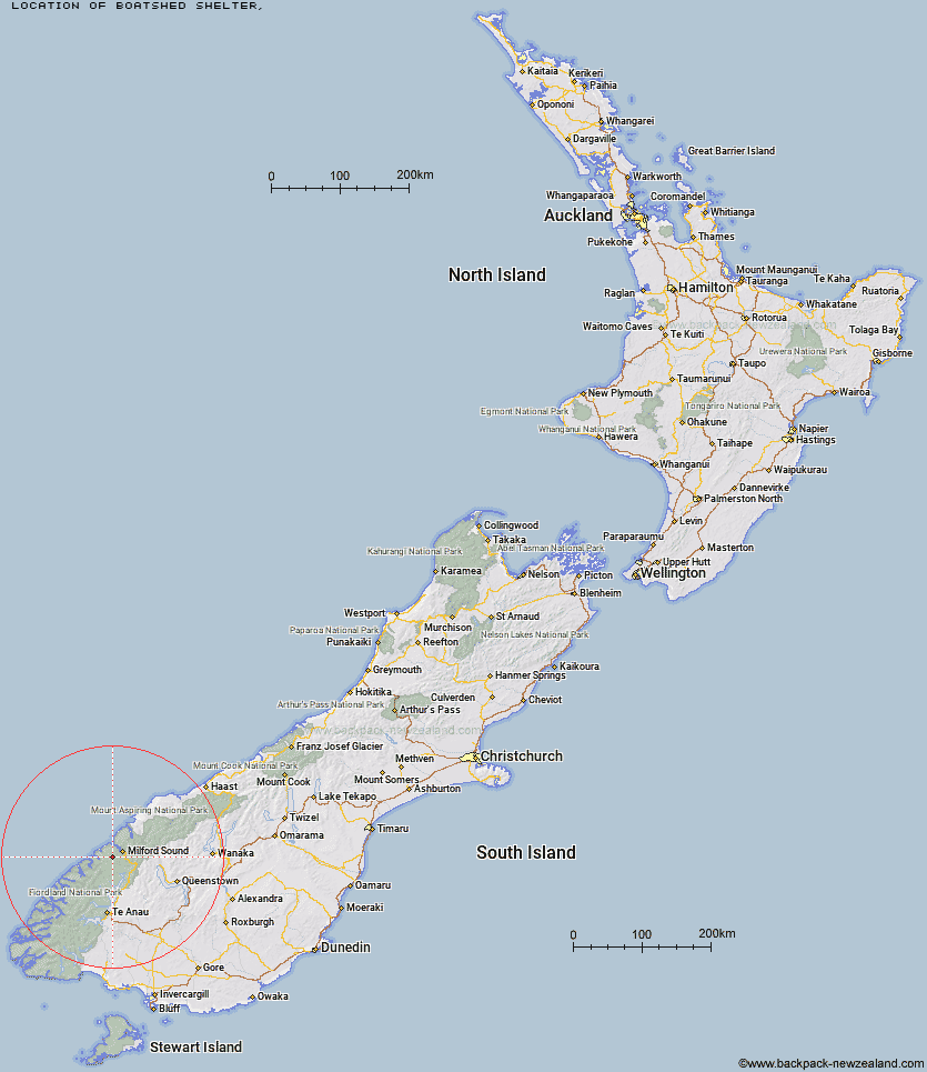
Topo Map showing location of Boatshed Shelter
This information is sourced from DoC, LINZ and Openstreetmap. Some of the hut photos are mine and the rest are from DoC. I will be adding an upload feature soon so people can photos of .Boatshed Shelter.
Latitude: -44.7378454875
Longitude: 167.801579976
Location:
Type of Hut:
Map: Topo Map | Road Map
Does this hut still exist? Have any more information? Contact
Latitude: -44.7378454875
Longitude: 167.801579976
Location:
Type of Hut:
Map: Topo Map | Road Map
Does this hut still exist? Have any more information? Contact
Scroll down to see a topographical map and road map showing the location of Boatshed Shelter
[ A ] [ B ] [ C ] [ D ] [ E ] [ F ] [ G ] [ H ] [ I ] [ J ] [ K ] [ L ] [ M ] [ N ] [ O ] [ P ] [ Q ] [ R ] [ S ] [ T ] [ U ] [ V ] [ W ] [ Y ] [ Z ]
Closest 20 Huts to Boatshed Shelter
These are as the crow fliesBoatshed Hut 0.04km Dumpling Hut 4.45km Giant Gate Shelter 5.24km Andersons Cascade Shelter 6.61km Quintin Lodge 7.07km Mackinnon Pass Shelter 7.47km Mintaro Hut 8.15km Sandfly Point Shelter 9.89km Pompolona Lodge 11.09km Bus Stop Shelter 11.41km Prairie Shelter 11.98km Hirere Shelter 15km Homer Hut 16.21km Gill's Bivvy 18.43km Phil's Bivvy 18.75km Clinton Hut 20.49km Turners Bivouac 21.71km Pawnbroker Rock 21.98km Glade House 22.73km Worsley Hut 22.91km The Divide Shelter 26.75km Lake Howden Hut 27.73km Sunshine Hut 27.76km Hidden Falls Hut 27.81km Lake Mackenzie Lodge 29.56km Lake Mackenzie Hut 29.57km Kaipo Hut 29.91km Glaisnock Hut 30.1km McKellar Lodge 30.75km McKellar Hut 30.92km Routeburn Falls Lodge 31.41km Routeburn Falls Hut 31.46km McKerrow Island Hut 32.06km Routeburn Flats Hut 32.72km Lake Alabaster Hut 34.5km Demon Trail Hut 34.59km Upper Caples Hut 35.23km Kay Creek Hut 35.77km Routeburn Shelter 37.72km Rats Nest Hut 38.08km